Area Overview for Foston (South Derbyshire)
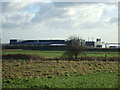
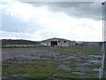
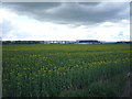
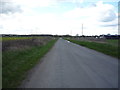
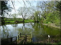
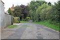
Photos of Foston (South Derbyshire)


Area Information
Foston (South Derbyshire) is a compact built-up area spanning 97.8 hectares, nestled in the heart of Derbyshire. With a median age of 70, it is a community shaped by older residents, reflecting a quieter, more established character. The area’s home ownership rate of 86% underscores its appeal as a stable, long-term living environment. Daily life here is defined by proximity to essential services, including two railway stations—Tutbury & Hatton and Burton—offering connections to nearby towns. Retail options are limited but practical, with Co-op Hatton, Tesco Hilton, and Aldi Hilton within reach. Foston (South Derbyshire) lacks the bustling energy of larger cities but offers a calm, low-maintenance lifestyle. Its smaller footprint means residents can access amenities without long commutes, though the area’s size also means it is not suited for those seeking sprawling urban diversity. For those prioritising security, safety, and a tight-knit community, Foston (South Derbyshire) presents a straightforward, no-frills option.
- Area Type
- Built Up Area 250
- Area Size
- 97.8 hectares
- Population
- Not available
- Population Density
- Not available
Lifestyle in Foston (South Derbyshire) is defined by proximity to essential retail and transport hubs. The Co-op Hatton, Tesco Hilton, and Aldi Hilton provide basic shopping needs within practical reach, making daily errands straightforward. The Tutbury & Hatton Railway Station and Burton station offer access to regional travel, though the area’s small size means most amenities are within walking distance. The absence of detailed data on parks, leisure facilities, or dining options suggests a minimal focus on recreation, with residents likely to rely on nearby towns for more extensive leisure activities. The character of daily life here is low-key, with a focus on convenience and stability. While the area lacks cultural or entertainment hubs, its simplicity suits those prioritising ease of access over urban vibrancy.
Amenities
Schools
| Rank | A + A* % | School | Type | Entry gender | Ages |
|---|
Explore more schools in this area
Go to Schools tabDemographics
The population of Foston (South Derbyshire) skews heavily towards older residents, with a median age of 70. This demographic profile suggests a community where retirement is the primary life stage, with households likely to be couples or single occupants. Home ownership is exceptionally high at 86%, indicating a lack of rental properties and a focus on long-term residency. The data does not specify household types or accommodation categories, but the overall composition appears to be homogeneous, with no notable ethnic or religious diversity reported. The absence of detailed deprivation metrics means the area’s quality of life cannot be assessed in terms of economic hardship, but the high home ownership rate implies financial stability for most residents. Foston (South Derbyshire) is not a place for young families or transient populations, but for those seeking a settled, low-activity lifestyle, it offers a straightforward demographic profile.
Household Size
Accommodation Type
Tenure
Ethnic Group
Religion
Household Composition
Age
Household Deprivation
NS-SEC
Explore more demographic insights in this area
Go to Demographics tabPlanning
Planning Constraints
- Crime RiskLocked