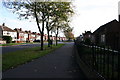
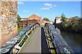
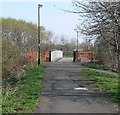
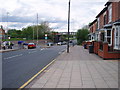
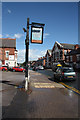
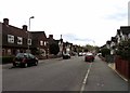
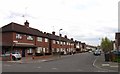
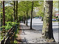
Area Overview for Fosse Ward
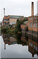
Photos of Fosse Ward


Area Information
Fosse Ward is a compact electoral ward situated within Leicester City unitary authority in the East Midlands region of England. This district forms part of the Leicester West parliamentary constituency and covers an area of just 1.8 square kilometres. Despite its small geographical footprint, the ward accommodates a population of 2,394 people, resulting in a population density of 1,351 people per square kilometre. Living in Fosse Ward means inhabiting a densely populated neighbourhood where residents experience close proximity to their neighbours. The area functions as a distinct block within the larger urban fabric of Leicester. You will find yourself surrounded by a community defined by its specific electoral boundaries and local governance structures. The ward represents a concentrated slice of the city where daily life is shaped by the interplay of limited space and a significant number of inhabitants. Prospective buyers should note that this is an established ward with defined administrative boundaries. The small land area relative to the populace suggests a neighbourhood focused on intensity rather than sprawl. Understanding the scale of Fosse Ward helps contextualise everything from local school catchments to traffic patterns. The community composition of Fosse Ward reveals a population skewed heavily towards older demographics. The median age across the ward stands at 70 years, indicating a mature population structure. Most residents fall within the older age bracket, suggesting the ward is home to many retirees or long-term settled families. Regarding housing tenure, only 38% of households in Fosse Ward own their homes outright. This figure implies that the majority of residents are homeowners who have bought their properties, rather than tenants or social rent recipients. The data does not specify detailed breakdowns for household composition, predominant ethnic groups, or religious affiliations. Consequently, there is no specific information available regarding the diversity of faiths or racial backgrounds within this specific ward. You cannot make definitive claims about cultural mix without further granular statistics. The absence of data on these social factors limits a full picture of community cohesion. However, the high home ownership rate combined with the age profile paints a clear statistical portrait: a neighbourhood dominated by older people who are likely well-established in their current residences. The housing landscape of Fosse Ward is characterised by a strong preference for ownership. With 38% of the population owning their homes, you are looking at a market where private residents hold the majority of property titles. This statistic suggests a stable housing stock where long-term owners rather than short-term renters dominate the register. The ward sits within Leicester City, which generally features a mix of urban and suburban housing, though specific property types for Fosse Ward alone are not itemised in the available records. You cannot confirm the prevalence of detached houses, semi-detached homes, or flats based solely on the current dataset. The home ownership percentage of 38% serves as your primary indicator of the market character. It implies that if you are buying a home in Fosse Ward, you are likely joining an existing community of established owners. The lower tenure figure compared to national averages often seen in rural areas highlights the dense, urban nature of living in this part of Leicester. Buyers should expect a market driven by ownership exchanges rather than a high volume of rent-to-own transactions. Digital connectivity in Fosse Ward is exceptional, presenting a major advantage for residents. The fixed broadband quality score reaches 100 out of 100, which is the highest possible rating. This status indicates that you will enjoy excellent internet speeds suitable for any modern requirement. High-speed connections support working from home, streaming high-definition media, and large file downloads without interruption. For anyone relying on robust digital infrastructure for daily tasks, living in Fosse Ward offers a seamless experience. While mobile network details are not provided in the current data, the outstanding fixed broadband score outweighs this missing information. You do not need to worry about poor internet service affecting your quality of life. The area is equipped with top-tier telecommunications infrastructure. This grade of service is rare for a ward of this size within an urban council area. Potential buyers can be confident that the digital backbone of their home in Fosse Ward will perform at a premium level. Safety considerations in Fosse Ward require a balanced view of risks based on official assessments. The crime risk level for the ward sits at a WARNING status with a score of 37. This places the area in the medium risk category, meaning crime rates are around average compared to other locations. You should apply standard security precautions when protecting your property, as is common practice anywhere. There is no evidence of extreme danger, but you must remain vigilant. Regarding environmental hazards, the flood risk assessment returns a CRITICAL rating with a score of 30.35. This result indicates high flood risk coverage within the ward, which is a serious concern for anyone planning to build or buy here. You must research individual property addresses thoroughly to understand specific vulnerability to flooding. Fortunately, planning constraints do not present similar prohibitions. The ward passes assessments for Ramsar wetland sites, Areas of Outstanding Natural Beauty, protected nature reserves, and protected woodland, all scoring at 0. This absence of protected status means there are no planning restrictions related to these conservation areas. However, the flood risk remains the primary environmental challenge you must factor into your decision to live in Fosse Ward. What is the character of the community in Fosse Ward?The community in Fosse Ward is skewed significantly towards older residents with a median age of 70 years old. This demographic structure suggests a quiet neighbourhood environment suited to those seeking stability. The ward lacks specific data on ethnic diversity or religious composition, indicating a need to look at broader Leicester statistics for full cultural context. Housing tenure is primarily owner-occupied, with 38% of households owning their homes, pointing to a settled population base rather than a transient rental market. How is the transport and internet connectivity for residents?Digital connectivity in Fosse Ward is outstanding. You will find a fixed broadband quality score of 100, which represents the highest possible rating. This excellent level of service ensures reliable high-speed internet for working from home and daily usage. There are no recorded constraints preventing you from accessing top-tier digital services in this location. What should I know about safety and environmental risks?Living in Fosse Ward involves managing two specific risks. The crime risk is rated as WARNING with a score of 37, indicating medium crime rates around the city average where standard security is advised. More significantly, the area carries a CRITICAL flood risk rating with a score of 30.35, indicating high flood risk coverage. While there are no planning constraints from protected woodlands or nature reserves, the potential for flooding is the primary environmental factor you must consider before purchasing a property in this ward. Does Fosse Ward have any planning restrictions or protected statuses?There are no planning constraints related to nature conservation in Fosse Ward. The ward passes all assessments for Ramsar sites, Areas of Outstanding Natural Beauty, protected nature reserves, and protected woodland, all showing a score of 0. This means you will not face restrictions linked to these designations. However, you must remain aware of the high flood risk assessment which scores critically low at 30.35. This environmental factor presents a greater limitation on development or living than any nature protection laws.
- Area Type
- District Borough Unitary Ward
- Area Size
- 1.8 km²
- Population
- 2394
- Population Density
- 1351 people/km²
Demographics
The community composition of Fosse Ward reveals a population skewed heavily towards older demographics. The median age across the ward stands at 70 years, indicating a mature population structure. Most residents fall within the older age bracket, suggesting the ward is home to many retirees or long-term settled families. Regarding housing tenure, only 38% of households in Fosse Ward own their homes outright. This figure implies that the majority of residents are homeowners who have bought their properties, rather than tenants or social rent recipients. The data does not specify detailed breakdowns for household composition, predominant ethnic groups, or religious affiliations. Consequently, there is no specific information available regarding the diversity of faiths or racial backgrounds within this specific ward. You cannot make definitive claims about cultural mix without further granular statistics. The absence of data on these social factors limits a full picture of community cohesion. However, the high home ownership rate combined with the age profile paints a clear statistical portrait: a neighbourhood dominated by older people who are likely well-established in their current residences. The housing landscape of Fosse Ward is characterised by a strong preference for ownership. With 38% of the population owning their homes, you are looking at a market where private residents hold the majority of property titles. This statistic suggests a stable housing stock where long-term owners rather than short-term renters dominate the register. The ward sits within Leicester City, which generally features a mix of urban and suburban housing, though specific property types for Fosse Ward alone are not itemised in the available records. You cannot confirm the prevalence of detached houses, semi-detached homes, or flats based solely on the current dataset. The home ownership percentage of 38% serves as your primary indicator of the market character. It implies that if you are buying a home in Fosse Ward, you are likely joining an existing community of established owners. The lower tenure figure compared to national averages often seen in rural areas highlights the dense, urban nature of living in this part of Leicester. Buyers should expect a market driven by ownership exchanges rather than a high volume of rent-to-own transactions. Digital connectivity in Fosse Ward is exceptional, presenting a major advantage for residents. The fixed broadband quality score reaches 100 out of 100, which is the highest possible rating. This status indicates that you will enjoy excellent internet speeds suitable for any modern requirement. High-speed connections support working from home, streaming high-definition media, and large file downloads without interruption. For anyone relying on robust digital infrastructure for daily tasks, living in Fosse Ward offers a seamless experience. While mobile network details are not provided in the current data, the outstanding fixed broadband score outweighs this missing information. You do not need to worry about poor internet service affecting your quality of life. The area is equipped with top-tier telecommunications infrastructure. This grade of service is rare for a ward of this size within an urban council area. Potential buyers can be confident that the digital backbone of their home in Fosse Ward will perform at a premium level. Safety considerations in Fosse Ward require a balanced view of risks based on official assessments. The crime risk level for the ward sits at a WARNING status with a score of 37. This places the area in the medium risk category, meaning crime rates are around average compared to other locations. You should apply standard security precautions when protecting your property, as is common practice anywhere. There is no evidence of extreme danger, but you must remain vigilant. Regarding environmental hazards, the flood risk assessment returns a CRITICAL rating with a score of 30.35. This result indicates high flood risk coverage within the ward, which is a serious concern for anyone planning to build or buy here. You must research individual property addresses thoroughly to understand specific vulnerability to flooding. Fortunately, planning constraints do not present similar prohibitions. The ward passes assessments for Ramsar wetland sites, Areas of Outstanding Natural Beauty, protected nature reserves, and protected woodland, all scoring at 0. This absence of protected status means there are no planning restrictions related to these conservation areas. However, the flood risk remains the primary environmental challenge you must factor into your decision to live in Fosse Ward. What is the character of the community in Fosse Ward?The community in Fosse Ward is skewed significantly towards older residents with a median age of 70 years old. This demographic structure suggests a quiet neighbourhood environment suited to those seeking stability. The ward lacks specific data on ethnic diversity or religious composition, indicating a need to look at broader Leicester statistics for full cultural context. Housing tenure is primarily owner-occupied, with 38% of households owning their homes, pointing to a settled population base rather than a transient rental market. How is the transport and internet connectivity for residents?Digital connectivity in Fosse Ward is outstanding. You will find a fixed broadband quality score of 100, which represents the highest possible rating. This excellent level of service ensures reliable high-speed internet for working from home and daily usage. There are no recorded constraints preventing you from accessing top-tier digital services in this location. What should I know about safety and environmental risks?Living in Fosse Ward involves managing two specific risks. The crime risk is rated as WARNING with a score of 37, indicating medium crime rates around the city average where standard security is advised. More significantly, the area carries a CRITICAL flood risk rating with a score of 30.35, indicating high flood risk coverage. While there are no planning constraints from protected woodlands or nature reserves, the potential for flooding is the primary environmental factor you must consider before purchasing a property in this ward. Does Fosse Ward have any planning restrictions or protected statuses?There are no planning constraints related to nature conservation in Fosse Ward. The ward passes all assessments for Ramsar sites, Areas of Outstanding Natural Beauty, protected nature reserves, and protected woodland, all showing a score of 0. This means you will not face restrictions linked to these designations. However, you must remain aware of the high flood risk assessment which scores critically low at 30.35. This environmental factor presents a greater limitation on development or living than any nature protection laws.
Household Size
Accommodation Type
Tenure
Ethnic Group
Religion
Household Composition
Age
Household Deprivation
NS-SEC
Explore more demographic insights in this area
Go to Demographics tabPlanning
Planning Constraints
- Flood RiskPremium
- Ramsar Wetland SitesPremium
- Area of Outstanding Natural BeautyPremium
- Protected Nature ReservePremium
- Protected WoodlandPremium