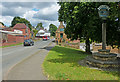
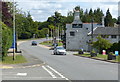
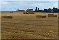
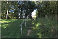
Area Overview for Flore
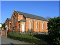
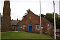
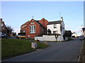
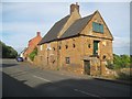
Photos of Flore


Area Information
Flore is a compact built-up area in England, covering 57.2 hectares. It is a small, established community with a median age of 70, suggesting a population skewed towards older residents. The area is defined by its modest size and the presence of key amenities within close proximity. Living in Flore offers a quiet, low-traffic environment, with homes predominantly owner-occupied at 80%. Daily life here is shaped by local retail options, a nearby railway station, and a strong sense of community. The area’s small footprint means residents can access essential services without long commutes. While it lacks the vibrancy of larger towns, Flore provides a simple, stable lifestyle. The presence of Flore Church of England Primary School, rated good by Ofsted, adds to its appeal for families. For those seeking a low-maintenance, mature community, Flore offers a straightforward, practical living experience.
- Area Type
- Built Up Area 250
- Area Size
- 57.2 hectares
- Population
- Not available
- Population Density
- Not available
Flore’s lifestyle is shaped by its proximity to essential amenities. Within practical reach are five retail outlets, including Budgens Weedon, Tesco Weedon, and Asda The, providing everyday shopping needs. The Long Buckby Railway Station offers access to regional travel, while the area’s small size means residents can walk or cycle to local services. The presence of Flore Church of England Primary School adds to the community’s character, though secondary education options are not available locally. The retail options suggest a focus on convenience rather than variety, with stores catering to basic needs. The area’s amenities support a simple, functional lifestyle, ideal for those prioritising ease of access over expansive leisure facilities.
Amenities
Schools
Flore Church of England Primary School is the only named school within the area. It is a primary school with a good Ofsted rating, indicating a satisfactory standard of education. The absence of secondary schools or other educational institutions within the data means that families may need to look beyond Flore for comprehensive schooling. This could be a consideration for parents seeking a full range of educational options. The single school listed suggests that the community’s educational needs are met at the primary level, but secondary education may require travel. The good rating provides reassurance for families prioritising quality in early education, though the limited school choice may be a drawback for those requiring a broader range of facilities.
| Rank | School | Type | Entry gender | Ages |
|---|
Explore more schools in this area
Go to Schools tabDemographics
Flore’s population is predominantly older, with a median age of 70. This suggests a community where retirement is the primary life stage, though the data does not specify the proportion of retirees versus other age groups. Home ownership is high, at 80%, indicating a stable, long-term resident base. The accommodation types and household composition are not detailed, but the overall demographic profile points to a population that is likely to be less diverse in terms of family structures. The area’s ethnic and religious diversity is not quantified, but the data notes that no single group dominates. This may imply a homogeneous community, though further specifics are not available. The absence of detailed deprivation data means it is unclear how economic factors influence quality of life, but the high home ownership rate suggests financial stability for many residents.
Household Size
Accommodation Type
Tenure
Ethnic Group
Religion
Household Composition
Age
Household Deprivation
NS-SEC
Explore more demographic insights in this area
Go to Demographics tabPlanning
Planning Constraints
- Crime RiskPremium