Area Overview for Five Village Ward
Photos of Five Village Ward

Area Information
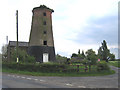
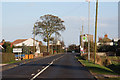
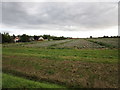
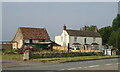
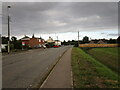
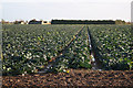
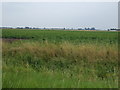
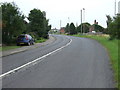
Five Village Ward covers an extensive land area of 60.4 km² within Nottinghamshire, England. This district borough unitary ward presents itself as a specific zone within the county, notable for its significant spatial spread rather than urban density. Living in Five Village Ward involves navigating a substantial territory that defines the daily travel distances for its residents. The area functions as a distinct administrative unit where household life unfolds across this large footprint. You should understand that your postcode location within this ward dictates local services and travel times across this considerable square kilometre base. The ward does not feature the concentrated population clusters of city centres. Instead, it operates as a broader geographical entity encompassing rural or semi-rural landscapes typical of the Nottinghamshire region. The sheer size of the ward influences how you experience living here. Distances between amenities, workplaces, and school zones will be greater than in more compact urban districts. Your perception of the local environment will shift depending on which specific part of the 60.4 km² boundary you call home. This administrative classification by Nottinghamshire County Council helps delineate jurisdictional responsibilities for local governance. As a prospective buyer, recognising the physical expanse of this ward is essential for planning your commute or school run. The area exists as a defined planning and electoral zone within the wider Nottinghamshire landscape.
- Area Type
- District Borough Unitary Ward
- Area Size
- 60.4 km²
- Population
- Not available
- Population Density
- Not available
Demographics
The community profile in Five Village Ward reflects an exceptionally mature population. Statistical data indicates a median age of 70, positioning this ward as a retirement or older-age neighbourhood. You will find that the vast majority of residents fall into the senior demographic, creating a quiet and established atmosphere. This age concentration suggests that local services and social activities cater primarily to older adults. The household composition supports this finding, with a high correlation between older residents and lifelong residency. Visiting schools would be unusual in most daily walks, as the community is defined by children rather than grandparents raising them alone. Home ownership stands at a robust 71%, indicating that most homes in Five Village Ward are owned outright or with a mortgage. This high figure suggests long-term stability and lower tenant turnover compared to urban rental hubs. The area lacks the transient nature often found in student quarters or city-centre rentals. Accommodation types are dominated by properties suitable for the age profile, such as upper floors or bungalows, though specific architectural data is not detailed here. The predominantly white ethnic group represents the primary demographic makeup, consistent with broader Nottinghamshire patterns. Religion data, while part of the total record, does not highlight a specific dominant congregation that alters the general secular or traditional feel. Families with young children are statistically less common here than elderly couples or retirees.
Household Size
Accommodation Type
Tenure
Ethnic Group
Religion
Household Composition
Age
Household Deprivation
NS-SEC
Explore more demographic insights in this area
Go to Demographics tabPlanning
Planning Constraints
- Flood RiskPremium
- Ramsar Wetland SitesPremium
- Area of Outstanding Natural BeautyPremium
- Protected Nature ReservePremium
- Protected WoodlandPremium
- Crime RiskPremium