Area Overview for Fiskerton (Newark and Sherwood)
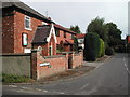
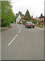
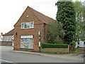
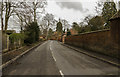
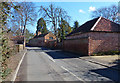
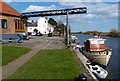
Photos of Fiskerton (Newark and Sherwood)


Area Information
Fiskerton, located within Newark and Sherwood, is a compact built-up area spanning 32.4 hectares. Its population, though not explicitly stated, is reflected in the high median age of 70, suggesting a community skewed toward older residents. This demographic profile shapes the area’s character, with a focus on stability and long-term residency. Home ownership is exceptionally high at 91%, indicating a strong presence of owner-occupied properties. Daily life here is supported by practical amenities, including five nearby rail stations—Fiskerton, Rolleston, and Bleasby among them—offering reliable connections to surrounding towns. Retail options are similarly accessible, with shops like M&S Southwell Green BP, Co-op Southwell, and Morrisons Daily within reach. Digital connectivity is robust, with broadband quality rated excellent (99/100) and mobile coverage good (83/100), ensuring seamless internet use for both work and leisure. Fiskerton’s blend of older demographics, strong home ownership, and nearby infrastructure positions it as a practical, low-maintenance choice for those prioritising convenience and safety.
- Area Type
- Built Up Area 250
- Area Size
- 32.4 hectares
- Population
- Not available
- Population Density
- Not available
Fiskerton’s lifestyle is shaped by its proximity to essential amenities. Retail options include M&S Southwell Green BP, Co-op Southwell, and Morrisons Daily, providing access to groceries, clothing, and household goods. These stores are within practical walking or driving distance, supporting daily errands and reducing the need for long commutes. While no parks or leisure facilities are listed in the data, the rail stations and retail hubs suggest a focus on convenience over expansive recreational spaces. The area’s practical amenities cater to a population prioritising accessibility over large-scale leisure options, making it ideal for those valuing efficiency in everyday living.
Amenities
Schools
| Rank | A + A* % | School | Type | Entry gender | Ages |
|---|
Explore more schools in this area
Go to Schools tabDemographics
The population of Fiskerton is predominantly older, with a median age of 70, the highest age group recorded. This suggests a community where retirees or long-term residents form the majority, influencing local services and social dynamics. Home ownership is exceptionally high at 91%, indicating that most residents live in properties they own rather than renting. While no specific data on household composition or accommodation types is provided, the high home ownership rate implies a stable, established population. The lack of detailed information on ethnic or religious diversity means broader demographic trends remain unexplored, but the age profile alone highlights a community with distinct needs and priorities. For prospective buyers, this demographic context may influence considerations about local amenities, healthcare access, and long-term residency suitability.
Household Size
Accommodation Type
Tenure
Ethnic Group
Religion
Household Composition
Age
Household Deprivation
NS-SEC
Explore more demographic insights in this area
Go to Demographics tabPlanning
Planning Constraints
- Crime RiskLocked