Area Overview for Fillingham
Photos of Fillingham

Area Information
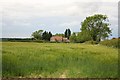
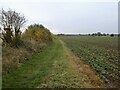
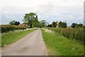
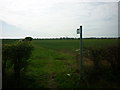
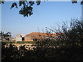
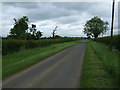
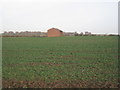
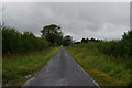
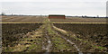
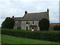
Living in Fillingham means settling into a civil parish defined by its simplicity and rural character. The area covers a substantial 14.6 km², offering enough space for a traditional village feel without the density of larger towns. You will find yourself in an environment where the daily rhythm is shaped by the community rather than commercial hustle. This locality represents a quiet corner of England where the focus remains on established neighbourhood dynamics and residential stability. Prospective buyers usually seek this setting for its established nature and lack of major development constraints. The village operates within a framework that prioritises local continuity over rapid expansion. Your daily life here involves navigating a layout that is predominantly residential, with amenities serving the specific needs of its long-term residents. The physical boundaries of the parish create a distinct identity, separating Fillingham from the surrounding countryside while maintaining a cohesive village centre. You are entering a market where homes have stood the test of time, reflecting the preferences of those who have already chosen this location. The area size provides a backdrop for a slower pace of life, ideal for those prioritising peace over proximity to urban infrastructure.
- Area Type
- Parish
- Area Size
- 14.6 km²
- Population
- Not available
- Population Density
- Not available
Demographics
The community in Fillingham reflects a settled population with a very distinct age profile. The median age stands at 70, indicating that the neighbourhood is home to a primarily elderly demographic. You are likely to interact with residents who have lived here for decades, contributing to a stable social fabric. While specific statistics on household composition and predominant ethnic groups are not quantified in the available records, the age data paints a clear picture of the population structure. Most common age ranges confirm that this is not an area attracting young professionals or families in the same way as urban districts. Instead, the village is a retirement destination or a home for older adults seeking a quiet environment. This demographic shift influences the type of community events and local services that sustain daily life. You will find a group of neighbours who value tradition and routine. The population composition suggests a homogeneity in lifestyle choices and spending priorities. Understanding that the residents are predominantly older helps you gauge the social atmosphere. This is a place where past residents remain, creating a continuous link between generations even if most of the current population belongs to the oldest generation.
Household Size
Accommodation Type
Tenure
Ethnic Group
Religion
Household Composition
Age
Household Deprivation
NS-SEC
Explore more demographic insights in this area
Go to Demographics tabPlanning
Planning Constraints
- Flood RiskPremium
- Ramsar Wetland SitesPremium
- Area of Outstanding Natural BeautyPremium
- Protected Nature ReservePremium
- Protected WoodlandPremium
- Crime RiskPremium