Area Overview for Farnsfield
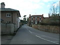
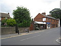
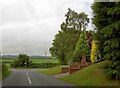
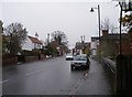
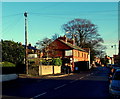
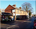
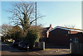
Photos of Farnsfield

Area Information
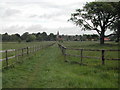
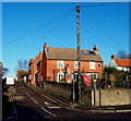
Farnsfield, a built-up area in England covering 97.9 hectares, offers a compact yet well-defined living environment. With a median age of 70, the community here is predominantly older, reflecting a demographic profile that prioritises stability and familiarity. The area’s home ownership rate of 80% suggests a strong presence of long-term residents, many of whom may have lived in the same properties for decades. Daily life in Farnsfield is shaped by its proximity to essential services, including multiple primary schools and retail outlets within walking distance. The area’s small size means that amenities are closely clustered, reducing the need for long commutes. For those seeking a quieter, less densely populated setting, Farnsfield provides a balance of practicality and accessibility. Its rail connections to nearby stations like Bleasby and Fiskerton open up broader regional opportunities, while the surrounding countryside offers a contrast to the built-up core. Living here means navigating a community where local institutions and familiar faces hold significant weight, making it a choice for those who value continuity over rapid change.
- Area Type
- Built Up Area 250
- Area Size
- 97.9 hectares
- Population
- Not available
- Population Density
- Not available
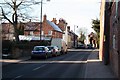
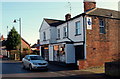
Farnsfield’s lifestyle is shaped by its proximity to essential amenities, including five retail outlets such as Co-op Farnsfield, Tesco Bilsthorpe, and Lincolnshire Co-operative Co. These shops provide everyday necessities, reducing the need for long trips to larger centres. The area’s rail stations—Bleasby, Fiskerton, and Thurgarton—offer practical connections to regional transport, enhancing access to nearby towns and services. While no parks or leisure facilities are explicitly listed, the compact layout of the area suggests that public spaces are integrated into the local environment. The presence of multiple schools and community-focused retail options indicates a lifestyle centred on local interaction and convenience. For residents, this means a balance of self-sufficiency and the ability to engage with broader networks through transport links, though the lack of detailed information on recreational amenities limits a full picture of leisure opportunities.
Amenities
Schools
Farnsfield is served by four primary schools, all of which are Church of England-affiliated or community-run institutions. These include Farnsfield Walter d’Ayncourt Community School, Farnsfield CofE Aided Primary School, and Farnsfield St Michael’s Church of England Primary School, which holds a ‘good’ Ofsted rating. The presence of multiple primary schools within the area ensures that families have several options for their children’s early education. The mix of community and faith-based schools reflects the area’s religious and social composition, though no data on secondary education is provided. For parents prioritising school quality, the ‘good’ rating at St Michael’s offers a benchmark for standards, while the variety of schools may accommodate different educational preferences. The proximity of these schools to residential areas reduces travel time, supporting a family-friendly environment.
| Rank | A + A* % | School | Type | Entry gender | Ages |
|---|---|---|---|---|---|
| 1 | N/A | Farnsfield Walter d'Ayncourt Community School | primary | N/A | N/A |
| 2 | N/A | Farnsfield CofE Aided Primary School | primary | N/A | N/A |
| 3 | N/A | Farnsfield St Michael's Church of England Primary (Voluntary Aided) School | primary | N/A | N/A |
| 4 | N/A | Farnsfield St Michael's Church of England Primary School | primary | N/A | N/A |
Explore more schools in this area
Go to Schools tabDemographics
The population of Farnsfield is characterised by an average age of 70, with the most common age range encompassing the total population. This suggests a community where older residents form a significant proportion, potentially influencing local services and social dynamics. Home ownership is high, with 80% of residents owning their properties, indicating a stable housing market with limited rental activity. The accommodation types and household composition are not specified, but the data implies a mix of family and single-occupancy homes. No specific ethnic or religious breakdown is provided, so diversity metrics remain unquantified. The absence of detailed deprivation data means that quality of life factors such as access to healthcare or social services cannot be assessed from this dataset. However, the high home ownership rate and low crime risk suggest a generally secure and self-sufficient population, with residents likely to have established long-term ties to the area.
Household Size
Accommodation Type
Tenure
Ethnic Group
Religion
Household Composition
Age
Household Deprivation
NS-SEC
Explore more demographic insights in this area
Go to Demographics tabPlanning
Planning Constraints
- Crime RiskLocked