Area Overview for Far Cotton and Delapre
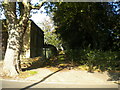
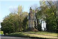
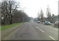
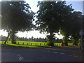
Photos of Far Cotton and Delapre
Area Information
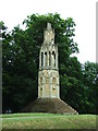
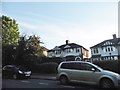
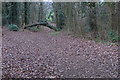
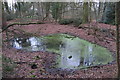
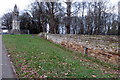
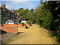
Living in Far Cotton and Delapre means residing in a civil parish characterised by deep historical roots and proximity to Northampton town. This 4.5 square kilometre settlement sits just a mile south of the town centre, offering a blend of rural tranquillity and urban accessibility. The area encompasses more than 550 acres of parkland centred on the restored Delapré Abbey, a former Cluniac nunnery founded in 1145. You are surrounded by historic landscapes that include formal gardens, an arboretum, and the remnants of a splendid water garden. The parish holds significant heritage, marked by the Eleanor Cross located alongside the London Road, one of only three surviving examples in England. Daily life here features walking routes through the estate and access to a wellbeing hub being developed in a 19th-century stable yard. With a population of 1,382 people, the community maintains a small-scale feel while remaining within easy reach of local amenities. Homes in Far Cotton and Delapre offer residents a connection to nearly 900 years of local history without the congestion of the wider East Midlands region.
- Area Type
- Parish
- Area Size
- 4.5 km²
- Population
- 1382
- Population Density
- 306 people/km²
Demographics
The community in Far Cotton and Delapre reflects a mature population profile. The median age for residents is 70 years, indicating that the area is predominantly home to older adults. This demographic skew suggests quiet streets and a slower pace of life compared to younger, more transient neighbourhoods. Home ownership stands at 56% of households, meaning just over half of the population owns their property outright or with a mortgage while the remainder rents. This ownership rate points to an area where many families or retirees have established roots for the long term. The total population density is 306 people per square kilometre, a figure that ensures minimal overcrowding while maintaining access to shared community spaces. Accommodation types and household compositions align with this older demographic, favouring stability over transient living arrangements. When you are considering living in Far Cotton and Delapre, expect a settled atmosphere where long-term residents form the core of daily interactions. The area offers a lived-in character typical of regions with significant historical estates and limited turnover.
Household Size
Accommodation Type
Tenure
Ethnic Group
Religion
Household Composition
Age
Household Deprivation
NS-SEC
Explore more demographic insights in this area
Go to Demographics tabPlanning
Planning Constraints
- Flood RiskPremium
- Ramsar Wetland SitesPremium
- Area of Outstanding Natural BeautyPremium
- Protected Nature ReservePremium
- Protected WoodlandPremium
- Crime RiskPremium