Area Overview for Exton and Horn
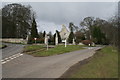
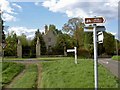
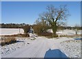
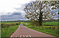
Photos of Exton and Horn


Area Information
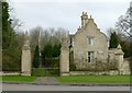
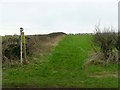
Living in Exton and Horn offers a quiet rural existence set within a civil parish covering 20.3 square kilometres. You will find a location defined by its spacious layout and traditional village feel rather than urban density. The area caters primarily to those seeking a slower pace away from city commutes. This parish exists as a distinct local governance area within England, providing a framework for community identity. Daily life here revolves around familiarity and established patterns common in countryside settings. There are no major high-speed corridors immediately threading through every street, giving the place a contained charm. You will experience a sense of isolation that many homebuyers value in the wider rural market. The environment supports residents who prefer gardens and open spaces over shopping malls and transport hubs. Exton and Horn remains a public-facing entity where local regulations and planning decisions directly affect property values. You gain access to a landscape that lacks the clutter of heavy industrial development. The area maintains a specific character that separates it from surrounding populations.
- Area Type
- Parish
- Area Size
- 20.3 km²
- Population
- Not available
- Population Density
- Not available
Demographics
The community of Exton and Horn displays a distinctly older profile compared to the national average. Half of all residents are aged 65 or over, with the median age hitting 70 years. This demographic shift suggests a retirement hotspot where families with young children find fewer counterparts. Over two-thirds of adults fall into the 45 to 64 age bracket, while under-twenty population numbers remain minimal. Most households consist of couples living together or single adults, with very few multi-generational families present. Home ownership stands at 69 per cent, meaning you are far more likely to buy than rent in these streets. The low percentage of landlords indicates a stock built for staying rather than transient living. You will encounter a settled population that has remained in the area for decades. This stability creates a predictable social environment but can limit intergenerational diversity. The age structure suggests quiet evenings rather than bustling nightlife or early morning football matches. Shopping trips often involve trips to nearby towns since local leisure options cater to mature tastes.
Household Size
Accommodation Type
Tenure
Ethnic Group
Religion
Household Composition
Age
Household Deprivation
NS-SEC
Explore more demographic insights in this area
Go to Demographics tabPlanning
Planning Constraints
- Flood RiskPremium
- Ramsar Wetland SitesPremium
- Area of Outstanding Natural BeautyPremium
- Protected Nature ReservePremium
- Protected WoodlandPremium
- Crime RiskPremium