Area Overview for Ewerby and Evedon
Photos of Ewerby and Evedon

Area Information
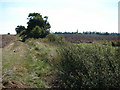
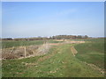
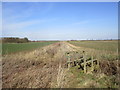
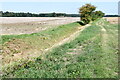
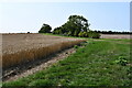
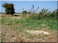
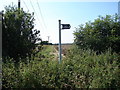
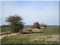
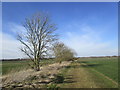
Living in Ewerby and Evedon means settling into a rural civil parish that spans 19.7 km² within the wider landscape of England. This parish offers a distinct identity shaped by its connection to surrounding natural features and its quiet residential character. The area appeals to those seeking a slower pace of life away from the noise of larger towns. Residents enjoy access to local amenities suited to daily living, though the rural setting implies limited immediate urban infrastructure. The community is defined by a significant proportion of long-term residents, creating a stable environment where neighbours often know one another. Daily life in Ewerby and Evedon revolves around a strong sense of place and established routines. You will find a settlement that values traditional living patterns over rapid development. The physical size of the parish provides enough space for open grounds while maintaining proximity to essential services found nearby. While living here offers peace and tranquillity, you must accept that remote locations often distance you from immediate high-speed transport links. Homes in the parish cater primarily to those able to commute from farther away or those retired into this quieter setting. The character of the area remains largely consistent with its historical roots, offering a straightforward rural experience without the complexities of major urban planning changes.
- Area Type
- Parish
- Area Size
- 19.7 km²
- Population
- Not available
- Population Density
- Not available
Demographics
The community in Ewerby and Evedon reflects a mature demographic profile with a median age of 70. This figure significantly exceeds national averages and indicates a neighbourhood dominated by the older generation. You are likely to meet residents who have called this parish home for decades rather than young families or transient workers. The high proportion of older adults shapes the local culture, driving a preference for stability and established neighbours over rapid turnover. Home ownership stands at 77% within Ewerby and Evedon. This statistic confirms that the area functions primarily as an owner-occupied market rather than a rental hub. The vast majority of households hold their properties outright, suggesting strong equity and a deep commitment to the location. Your interactions with neighbours will predominantly involve other owners, fostering a sense of investment in the community's long-term upkeep. The age structure and ownership patterns create a cohesive society focused on enjoying retirement years or later life stages.
Household Size
Accommodation Type
Tenure
Ethnic Group
Religion
Household Composition
Age
Household Deprivation
NS-SEC
Explore more demographic insights in this area
Go to Demographics tabPlanning
Planning Constraints
- Flood RiskPremium
- Ramsar Wetland SitesPremium
- Area of Outstanding Natural BeautyPremium
- Protected Nature ReservePremium
- Protected WoodlandPremium
- Crime RiskPremium