Area Overview for Evington Ward
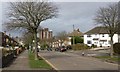
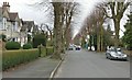
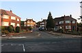
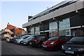
Photos of Evington Ward


Area Information
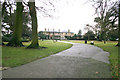
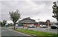
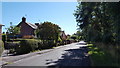
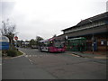
Living in Evington Ward offers a densely packed residential experience within a compact footprint of just 5.1 km². The ward accommodates a population of 3,465 people, resulting in a high population density of 686 people per square kilometre. This concentration creates a tight-knit environment where neighbours are rarely far away, distinguishing it from sprawling suburban outskirts. Daily life here moves quickly due to the limited space, yet the area maintains a defined character as a local district within the broader borough structure. Prospective buyers should appreciate that this locale prioritises efficiency and community proximity over expansive green corridors or wide-open spaces. The distinction of Evington Ward lies in its status as a ward-level administrative unit that serves a specific, concentrated group of residents. When considering homes in Evington Ward, you are entering a zone defined by its high resident-per-square-metre ratio. This density influences local services, traffic patterns, and the general pace of everyday activities. You will find a setting that is established and functional, catering to those who prefer a neighbourhood feel without the isolation of rural living. The area presents a clear picture of urban settlement within a larger English local government framework.
- Area Type
- District Borough Unitary Ward
- Area Size
- 5.1 km²
- Population
- 3465
- Population Density
- 686 people/km²
Demographics
The community in Evington Ward presents a distinct demographic profile dominated by older residents. The median age of the population sits at 70 years, indicating a significant proportion of the inhabitants are retirees or established older adults. While the data categorises age distribution broadly under 'Age: Total', the central tendency clearly points towards a mature neighbourhood where daily life caters to an older demographic. Home ownership stands at a strong 62% for households in this area. This high rate suggests that many families have settled permanently rather than renting transiently. The data presents household composition and accommodation type as aggregate totals, meaning the ward contains a mix of living arrangements that align with the age profile. You will likely encounter a society where stability and long-term residence define the social fabric. The fact that over six out of ten residents own their homes implies a secure tenure where owners invest in maintaining their properties. Religious and ethnic diversity data are recorded as totals, reflecting a standard population mix within the ward's boundaries. For those seeking homes in Evington Ward, the environment is fundamentally shaped by its older residents who have likely built deep local connections over decades. The demographic reality creates a quiet, settled atmosphere where neighbours know one another's routines.
Household Size
Accommodation Type
Tenure
Ethnic Group
Religion
Household Composition
Age
Household Deprivation
NS-SEC
Explore more demographic insights in this area
Go to Demographics tabPlanning
Planning Constraints
- Flood RiskPremium
- Ramsar Wetland SitesPremium
- Area of Outstanding Natural BeautyPremium
- Protected Nature ReservePremium
- Protected WoodlandPremium
- Crime RiskPremium