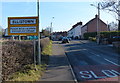
Area Overview for Ellistown
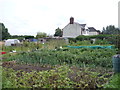
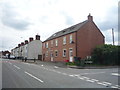
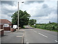
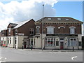
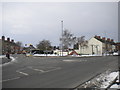
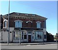
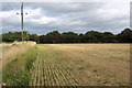
Photos of Ellistown

Area Information
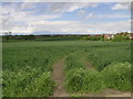
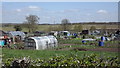
Ellistown is a built-up area in England covering 70.4 hectares, comparable in size to a small town. With a median age of 70, it reflects a community skewed towards older residents, suggesting a stable, long-term population. The area’s 77% home ownership rate indicates a strong presence of owner-occupied properties, which may appeal to those seeking a settled lifestyle. Daily life here is likely shaped by proximity to essential services, including retail outlets and a nearby railway station. While specific details about cultural or social hubs are absent, the low crime risk score of 69 suggests a generally safe environment. For buyers, Ellistown offers a compact, well-connected setting with access to primary education and practical amenities. Its character is defined by simplicity and functionality, making it suitable for those prioritising security, convenience, and a slower pace of life. The area’s limited size means residents are likely within walking or short driving distance of key facilities, reinforcing its appeal for those valuing accessibility.
- Area Type
- Built Up Area 250
- Area Size
- 70.4 hectares
- Population
- Not available
- Population Density
- Not available
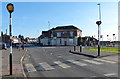
Ellistown’s lifestyle is shaped by its proximity to practical amenities. The area includes five retail outlets, such as Asda Ellistown, Aldi Swinfen Vale, and Morrisons Daily, providing access to groceries, household goods, and other essentials. These stores cater to daily needs, reducing the necessity for long trips to larger centres. The Shackerstone Railway Station adds connectivity, enabling travel to nearby destinations. While the data does not mention parks or leisure facilities, the presence of retail and transport options suggests a focus on convenience over expansive recreational spaces. Residents can expect a straightforward, functional lifestyle with easy access to shopping and transport. The limited details on leisure options mean buyers should explore the area firsthand to gauge its appeal for those prioritising outdoor activities or cultural amenities.
Amenities
Schools
The nearest school to Ellistown is Ellistown Community Primary School, which serves the area’s younger residents. Rated “good” by Ofsted, the school provides a foundation for primary education. While no secondary schools are listed, the presence of a primary school suggests that families with young children may find the area suitable for their needs. The absence of higher education institutions or specialist schools means parents may need to look beyond Ellistown for secondary schooling options. However, the quality of the primary school could be a significant draw for buyers prioritising strong early education. The single school listed indicates a limited range of educational choices, which may be a consideration for families with older children or those requiring specialist provisions.
| Rank | School | Type | Entry gender | Ages |
|---|
Explore more schools in this area
Go to Schools tabDemographics
Ellistown’s population has a median age of 70, indicating a community predominantly composed of older adults. The most common age range is listed as “Total,” suggesting aggregated data rather than segmented demographics. Home ownership is high, with 77% of residents owning their homes, a figure that implies stability and long-term residency. Accommodation types and household composition are not specified, but the overall data points to a population that is likely composed of single-person households or couples without children. The predominant ethnic group and religious affiliation are also not detailed, though the absence of specific figures does not necessarily reflect a lack of diversity. The area’s demographic profile suggests a mature, established community with limited turnover, which may influence local services and amenities. For buyers, this profile indicates a neighbourhood where property values may be less volatile, though it also means a distinct, age-focused social dynamic.