Area Overview for Eckington North Ward
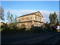
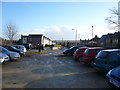
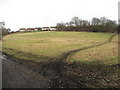
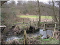
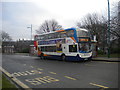
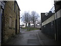
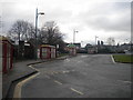
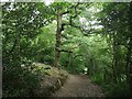
Photos of Eckington North Ward
Area Information
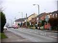
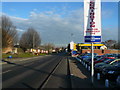
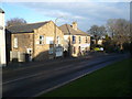
Eckington North Ward stands as a defined district unit within the broader borough structure of Eckington, covering a specific landmass of 3.2 square kilometres. You will find this area characterised by a high proportion of established residents rather than transient populations. The community reflects a clear preference for stability, with seven out of every ten households listing themselves as homeowners. This concentration of ownership suggests a neighbourhood where long-term families have put down significant roots over many years. Daily life here centres around quiet residential streets and established community bonds rather than the transient energy found in larger commercial hubs. The physical footprint of 3.2km² provides enough space for greenery and communal areas without feeling expansive or isolated. Living in Eckington North Ward means engaging with a settled environment where neighbours often know one another well. The area does not cater particularly to young professionals or students, as the average resident is significantly older than the national average. This demographic reality shapes the local rhythm, with services and amenities likely tailored to the needs of families and retirees. When you consider buying homes in Eckington North Ward, you are entering an environment defined by permanence and a slow-paced, traditional way of life.
- Area Type
- District Borough Unitary Ward
- Area Size
- 3.2 km²
- Population
- Not available
- Population Density
- Not available
Demographics
The people of Eckington North Ward have a distinct age profile that shapes the entire community dynamic. The median age here is 70 years, which is substantially higher than most modern towns. This indicates that the majority of the population falls into the senior demographic, creating a neighbourhood where decisions and interactions revolve around retirement living and mature lifestyles. Over half the residents are aged over 65, while the youngest demographic appears least represented compared to other districts. Home ownership sits at a robust 73% within this ward, reinforcing the picture of a settled, long-term community. This high percentage of owner-occupied properties contrasts with areas where young professionals rent short-term or move frequently. Consequently, local schools near Eckington North Ward primarily serve grandchildren and young families who have chosen this specific location for their own independence. Household compositions reflect multi-generational living or single-earner retired couples rather than the shared tenancies common in city centres. The lack of data on specific ethnic group breakdowns or religious affiliations does not diminish the clarity of the age and tenure picture. You are looking at a community built on stability rather than rapid turnover.
Household Size
Accommodation Type
Tenure
Ethnic Group
Religion
Household Composition
Age
Household Deprivation
NS-SEC
Explore more demographic insights in this area
Go to Demographics tabPlanning
Planning Constraints
- Flood RiskPremium
- Ramsar Wetland SitesPremium
- Area of Outstanding Natural BeautyPremium
- Protected Nature ReservePremium
- Protected WoodlandPremium
- Crime RiskPremium