Area Overview for East Retford West Ward
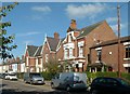
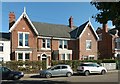
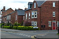
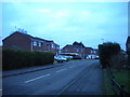
Photos of East Retford West Ward
Area Information
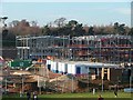
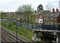
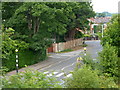
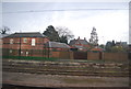
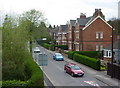
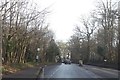
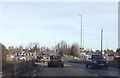
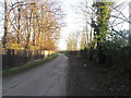
Living in East Retford West Ward offers residents a distinctly quiet lifestyle within a compact geographical footprint. This district borough unitary ward covers exactly 2.9 km², creating a tightly knit environment where neighbours are rarely far away. The area sits within the historic market town of East Retford, providing a stable residential setting characterised by a mature community feel. Daily life here moves at a predictable pace, defined more by proximity to local amenities than by urban hustle or expansive suburban sprawl. Prospective buyers looking for a defined, contained postcode should note the ward's precise boundaries, which focus residential density within these specific limits. The environment feels established rather than developing, with a sense of permanence that appeals to those seeking stability. You are entering an area where the boundaries are clear, and the community identity is well-rooted in its location as part of the wider East Retford borough structure. This specific ward provides a focused introduction to living in the town without the noise and congestion often found in central retail cores. Your journey into this neighbourhood begins with an understanding of its modest size and its role as a key residential component of the local authority area.
- Area Type
- District Borough Unitary Ward
- Area Size
- 2.9 km²
- Population
- Not available
- Population Density
- Not available
Demographics
The community in East Retford West Ward skews significantly towards older residents, with a median age of 70. This demographic profile indicates a population dominated by retirees or pre-retirees who have put down roots in the locality. When considering homes in East Retford West Ward, you should expect a neighbourhood where the demographic reality centres on an ageing population rather than young families or students. Household composition and accommodation types reflect this older cohort, suggesting larger dwellings adapted for single occupants or couples rather than multi-generational homes. Furthermore, home ownership stands at a robust 59%, confirming that this area is primarily owned by its long-term residents rather than occupied by transient tenants. This high ownership rate supports the view that the local economy relies heavily on fixed-income retirees rather than high-turnover rental markets. Ethnic and religious diversity metrics are not broken down in the available data, so the area likely reflects the broader statistical norms of the surrounding East Retford region without distinctive minority clustering. For your quality of life, the age profile suggests a retiree-friendly environment with lower noise levels and a community focused on leisure rather than early-morning commutes.
Household Size
Accommodation Type
Tenure
Ethnic Group
Religion
Household Composition
Age
Household Deprivation
NS-SEC
Explore more demographic insights in this area
Go to Demographics tabPlanning
Planning Constraints
- Flood RiskPremium
- Ramsar Wetland SitesPremium
- Area of Outstanding Natural BeautyPremium
- Protected Nature ReservePremium
- Protected WoodlandPremium
- Crime RiskPremium