Area Overview for East Retford North Ward
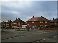
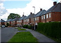
Photos of East Retford North Ward
Area Information
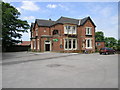
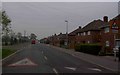
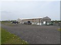
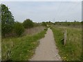
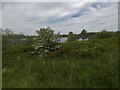
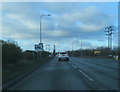
East Retford North Ward occupies a defined urban and suburban space in the Bassetlaw district of Nottinghamshire. This electoral ward covers an area size of 3.9 km² and serves as the home to 6,351 residents according to the 2021 Census. The community centres on the Hallcroft estate, reflecting a developed environment rather than a rural landscape. You will find this ward within the East Midlands region, specifically chosen as a district borough unitary ward where governance is handled at the local council level. Life here operates on a scale that balances suburban convenience with neighbourhood intimacy. The ward elects three councillors to the Bassetlaw District Council who serve four-year terms, providing a clear chain of local representation for registered voters. As of 2019, 5,013 residents were recorded as registered voters, indicating a stable electorate with high participation potential. The estate's establishment in 1979 marks a significant historical milestone, as the boundary was created following a review by the Local Government Boundary Commission for England. While minor adjustments occurred in 2002, the core identity of the ward has remained consistent for over four decades. Living in East Retford North Ward means residing in a zone where infrastructure predates recent housing boom periods. The area comprises the northern section of Retford, offering established services and amenities without the density of the town centre itself. You step into a space defined by its administrative history and demographic shifts, where the majority of the population identifies with the ward's specific electoral boundaries. This location provides a practical base for those seeking proximity to East Retford while maintaining the distinct character of the Hallcroft estate surroundings.
- Area Type
- District Borough Unitary Ward
- Area Size
- 3.9 km²
- Population
- Not available
- Population Density
- Not available
Demographics
The community within East Retford North Ward presents a distinct age profile compared to many national averages. The median age sits at 70 years, placing this ward among the most mature residential areas in the region. A significant portion of the 6,351 residents are over the age of 65, creating a demographic landscape where retirement and later-life settlement are common themes. Conversely, the ward also sustains a working-age population, with 55.8% of residents falling between 18 and 64 years old. This mix suggests a neighbourhood where families with older dependents or retired couples reside alongside those actively contributing to the local economy. Home ownership is the dominant tenure type for this community. Data indicates that 68% of households own their homes outright or with a mortgage, signalling a strong attachment to the area and established roots. The remaining 32% of households likely comprise private renters or shared owners, contributing to a balanced rental market within the ward. Religiously, the population is fairly mixed, with 57% identifying as Christian and 36% stating they have no religion. The remaining demographic divides include smaller groups such as Muslims, Buddhists, Hindus, and Sikhs, alongside those identifying as Jewish. Ethnically, the ward is predominantly white, with 97% of the population identifying on these grounds. The 3% comprising other ethnic groups include Asian, Black, Arab, mixed/multiple, and other backgrounds. This diversity, while specialised, adds to the social fabric of the Hallcroft estate. You are looking at a demographic where longevity and stability are evident, characterised by high home ownership and a mature age structure that defines the daily rhythm of life in East Retford North Ward.
Household Size
Accommodation Type
Tenure
Ethnic Group
Religion
Household Composition
Age
Household Deprivation
NS-SEC
Explore more demographic insights in this area
Go to Demographics tabPlanning
Planning Constraints
- Flood RiskPremium
- Ramsar Wetland SitesPremium
- Area of Outstanding Natural BeautyPremium
- Protected Nature ReservePremium
- Protected WoodlandPremium
- Crime RiskPremium