Area Overview for East Haddon
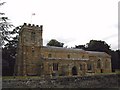
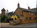
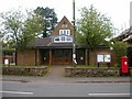
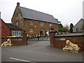
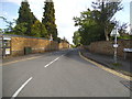
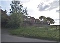
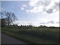
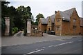
Photos of East Haddon

Area Information
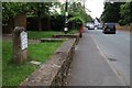
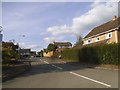
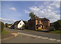
East Haddon is a compact built-up area spanning 37.5 hectares, nestled in England. Its population, though not explicitly stated, is reflected in its demographics, with a median age of 70, suggesting a community skewed towards older residents. Daily life here is shaped by proximity to essential services, including a railway station at Long Buckby and a range of retail outlets such as Co-op Long, Budgens Seaton, and Tesco Duston. The area’s low crime risk, with a safety score of 93, reinforces its appeal as a secure place to live. While the data does not specify historical context, the presence of a Church of England Primary School with an outstanding Ofsted rating indicates a focus on education and community cohesion. For those seeking a quieter, well-connected locale with accessible amenities, East Haddon offers a blend of practicality and stability.
- Area Type
- Built Up Area 250
- Area Size
- 37.5 hectares
- Population
- Not available
- Population Density
- Not available
The lifestyle in East Haddon is defined by its accessible amenities, including five retail outlets like Co-op Long, Budgens Seaton, and Tesco Duston, which cater to daily needs. The Long Buckby Railway Station offers connectivity to broader transport networks, though specifics on service frequency are not provided. The area’s compact size means residents can easily reach shops, services, and the railway station without lengthy journeys. While parks and leisure facilities are not detailed in the data, the presence of a primary school and retail options suggests a community-oriented environment. This proximity to essentials enhances the practicality of daily life, making East Haddon suitable for those valuing convenience.
Amenities
Schools
East Haddon’s primary educational offering is the East Haddon Church of England Primary School, which holds an outstanding Ofsted rating. This school serves the local community and is a key asset for families prioritising quality education. The data does not list secondary schools or other educational institutions, but the presence of a primary school with an excellent rating suggests a focus on early education. For families, this school’s performance is a significant draw, though the absence of further schooling options may necessitate commuting for older children. The school’s rating underscores the area’s commitment to educational standards, making it a strong consideration for homebuyers with children.
| Rank | School | Type | Entry gender | Ages |
|---|
Explore more schools in this area
Go to Schools tabDemographics
The population of East Haddon has a median age of 70, with the most common age range encompassing all age groups. Home ownership is high, at 80%, suggesting a community of long-term residents rather than transient renters. The data does not specify household composition or accommodation types, but the overall figures imply a settled population. The predominant ethnic group and religious affiliation are listed as "total," meaning no specific breakdown is available. This lack of granular detail means the area’s diversity remains unquantified. However, the high home ownership rate and older median age suggest a demographic prioritising stability over mobility. For buyers, this indicates a market with established properties and fewer turnover pressures.
Household Size
Accommodation Type
Tenure
Ethnic Group
Religion
Household Composition
Age
Household Deprivation
NS-SEC
Explore more demographic insights in this area
Go to Demographics tabPlanning
Planning Constraints
- Crime RiskPremium