Area Overview for East Goscote
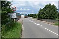
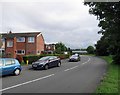
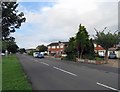
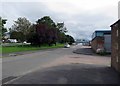
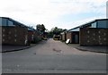
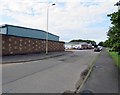
Photos of East Goscote


Area Information
East Goscote is a built-up area in England covering 73 hectares, with a population profile skewed toward older residents, reflected in its median age of 70. This suggests a community that values stability and long-term residency. The area’s compact size makes it practical for daily life, with amenities and services within easy reach. Home ownership is high at 87%, indicating a strong sense of local attachment. The low crime risk score of 83 — a pass rating — reinforces the area’s reputation for safety. For residents, East Goscote offers a quiet, established environment with access to nearby schools, rail networks, and retail hubs. Its proximity to Syston, Sileby, and Barrow upon Soar railway stations connects it to broader regional travel options, while local shops like Morrisons and Iceland cater to everyday needs. The blend of safety, convenience, and community character makes it appealing to those seeking a settled lifestyle.
- Area Type
- Built Up Area 250
- Area Size
- 73.0 hectares
- Population
- Not available
- Population Density
- Not available
East Goscote’s residents have access to a range of nearby amenities that support daily life. Retail options include Morrisons Daily, M&S Branston BP, and Iceland Leicester, providing essentials for shopping. The area’s rail and metro connections — including Syston, Sileby, and Barrow upon Soar stations — ensure easy access to public transport, while the Great Central Railway and Leicester North metro links offer further connectivity. Though the data does not mention parks or leisure facilities, the presence of local shops and transport hubs suggests a practical, convenience-driven lifestyle. The blend of retail, transport, and proximity to regional networks makes East Goscote suitable for those prioritising accessibility over expansive leisure options.
Amenities
Schools
The primary school nearest to East Goscote is Broomfield Community Primary School, which has an Ofsted rating of “good.” This indicates a school that meets standards in teaching quality and student outcomes. The absence of secondary schools or other educational institutions in the data means families may need to look beyond the immediate area for secondary education. However, the presence of a well-rated primary school is a key consideration for families prioritising early education. The school’s rating suggests a reliable foundation for children’s learning, though parents should verify whether the school’s catchment area includes East Goscote to ensure accessibility.
| Rank | A + A* % | School | Type | Entry gender | Ages |
|---|---|---|---|---|---|
| 1 | N/A | Broomfield Community Primary School | primary | N/A | N/A |
| 2 | N/A | Broomfield Community Primary School | primary | N/A | N/A |
Explore more schools in this area
Go to Schools tabDemographics
East Goscote’s population has a median age of 70, with the most common age range encompassing all demographics. This suggests a community where older residents form a significant portion, though the data does not specify proportions. Home ownership is exceptionally high at 87%, indicating most residents live in properties they own, which may contribute to a stable, long-term community feel. The accommodation types and household composition are listed as totals, meaning no breakdown of family structures or housing styles is available. The predominant ethnic group and religious affiliation are also aggregated, so no specific details about diversity or cultural composition can be provided. The high home ownership rate and older demographic likely shape a local culture prioritising familiarity and continuity, though the data does not quantify deprivation levels or their impact on quality of life.
Household Size
Accommodation Type
Tenure
Ethnic Group
Religion
Household Composition
Age
Household Deprivation
NS-SEC
Explore more demographic insights in this area
Go to Demographics tabPlanning
Planning Constraints
- Crime RiskLocked