Area Overview for Duston East Ward
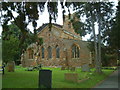
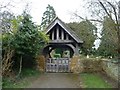
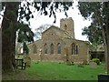
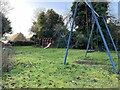
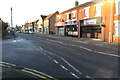
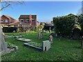
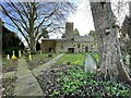
Photos of Duston East Ward
Area Information
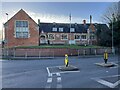
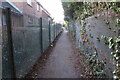
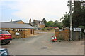
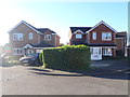
Duston East Ward is a compact district covering just over three square kilometres within the borough of Northamptonshire. You will find a community defined by its settled character, where daily life revolves around stability and long-term residence. The area functions as a self-contained neighbourhood rather than a sprawling urban extension, offering a quiet residential experience within England. Living in Duston East Ward means accepting a setting where the population is relatively stable and the environment is calm. This is not a high-growth zone but a place where residents value peace of order above rapid development. The ward provides a distinct option for those seeking a home in Duston East Ward without the pressures of changing districts. You can expect a straightforward journey to nearby facilities, with the area's size ensuring you are never far from your own doorstep. The local vibe is one of consistency, reflecting the deep roots of the people who have called this patch of land home for generations. If you are considering homes in Duston East Ward, you are looking at a place where routine is predictable and the surroundings remain unchanged by sudden shifts in population or market trends. This stability forms the core of what makes living here so distinct for a buyer arriving from a more transient location.
- Area Type
- District Borough Unitary Ward
- Area Size
- 3.0 km²
- Population
- Not available
- Population Density
- Not available
Demographics
The community in Duston East Ward is characterized by an exceptionally mature population, with a median age of 70 years old. This demographic profile reflects a neighbourhood settled largely by retirees and long-term adults rather than families or young professionals. Most residents fall into the total age category, suggesting a homogeneous group sharing similar life stages and lifestyle needs. This age distribution creates a quiet atmosphere where the primary considerations shift towards accessibility and local amenities rather than entertainment or schooling. Safety remains a priority for this demographic, supported by low crime risk scores. There is a high sense of ownership within the ward, with eighty per cent of homes occupied by their owners. This figure underscores a deep commitment to the locality, as owning property here is the norm rather than the exception. The household composition supports this picture of stability, with few transient occupants moving through the streets. You will find that the people living in Duston East Ward have chosen to put down roots permanently. This contrasts sharply with areas where rental properties dominate, creating a different social fabric. The demographics of Duston East Ward are simple and direct, favouring individuals who plan to stay put for the foreseeable future.
Household Size
Accommodation Type
Tenure
Ethnic Group
Religion
Household Composition
Age
Household Deprivation
NS-SEC
Explore more demographic insights in this area
Go to Demographics tabPlanning
Planning Constraints
- Flood RiskPremium
- Ramsar Wetland SitesPremium
- Area of Outstanding Natural BeautyPremium
- Protected Nature ReservePremium
- Protected WoodlandPremium
- Crime RiskPremium