Area Overview for Draycott & Risley Ward
Photos of Draycott & Risley Ward
Area Information
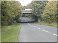
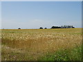
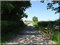
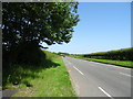
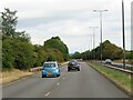
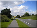
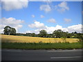
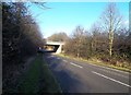
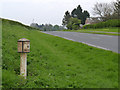
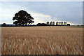
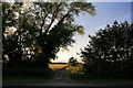
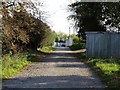
Living in Draycott & Risley Ward offers a distinct residential experience within the Erewash borough of Derbyshire. This district council ward spans 14.7 km² and encompasses the villages of Draycott and Risley. Draycott sits approximately 6 miles east of Derby and 3 miles south-west of Long Eaton, positioning the area within the East Midlands region. The location sits at coordinates around 52.89442°N 1.34147°W, offering a specific setting for those seeking homes in this part of England. You will find a community radius centred on these two villages, providing a localized environment for daily life. The ward functions as a defined administrative unit with code E05010609, ensuring clear local governance structures. Residents enjoy proximity to larger towns without urban congestion, creating a balanced lifestyle between rural quiet and town access. When considering homes in Draycott & Risley Ward, you are looking at an area where property ownership is the norm. The demographic profile suggests a settled population rather than a transient rental market. The physical footprint of 14.7 km² limits sprawl, meaning local amenities support a tight-knit community feel. This ward provides a clear geographic identity for prospective movers. The specific distances to Derby and Long Eaton define the commute potential for workers based in Greater Manchester or Nottinghamshire. You can expect a neighbourhood character shaped by its historic village roots and its current status as a functional ward within Derbyshire.
- Area Type
- District Borough Unitary Ward
- Area Size
- 14.7 km²
- Population
- Not available
- Population Density
- Not available
Demographics
The community profile of Draycott & Risley Ward is defined by an older population. The median age stands at 70 years, indicating a predominantly elderly neighbourhood. This age profile shapes how residents interact with local services and amenities. Most inhabitants fall into the total age category, with fewer young families compared to rapidly growing urban districts. Home ownership reaches 73% in Draycott & Risley Ward, cementing its status as a established residential area. This high ownership rate suggests long-term residents who have invested in their local homes. You will encounter a stable housing stock rather than high levels of rental turnover. The household composition reflects this stability, with many families living in the same properties for decades. The area encompasses a significant proportion of the total population characteristics found in the borough. Accommodation types reflect needs specific to this age demographic, prioritising accessibility and maintenance over massive scale development. Ethnically, the area aligns with the predominant groups in the wider county, though specific diversity statistics are not isolated in this ward report. Religious affiliations within Draycott & Risley Ward mirror broader regional trends, with no single minority faith dominating the local landscape. The demographic data paints a picture of a mature community where change happens slower than in satellite towns. Buyers looking for homes in this area should expect a neighbourhood populated by established locals rather than a mix of transient workers and families.
Household Size
Accommodation Type
Tenure
Ethnic Group
Religion
Household Composition
Age
Household Deprivation
NS-SEC
Explore more demographic insights in this area
Go to Demographics tabPlanning
Planning Constraints
- Flood RiskPremium
- Ramsar Wetland SitesPremium
- Area of Outstanding Natural BeautyPremium
- Protected Nature ReservePremium
- Protected WoodlandPremium
- Crime RiskPremium