Area Overview for Doveridge
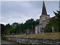
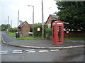
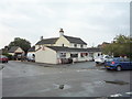
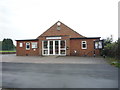
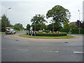
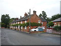
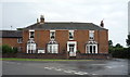
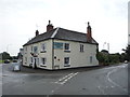
Photos of Doveridge


Area Information
Doveridge is a compact built-up area in England, spanning 69.7 hectares. Its small size means the community is tightly knit, with daily life revolving around local amenities and nearby towns. The area’s median age of 70 suggests a population skewed towards older residents, which shapes the pace of life and social dynamics. Despite its modest size, Doveridge is positioned near Uttoxeter, offering access to larger retail hubs and transport links. Residents benefit from a blend of rural tranquillity and practical connectivity, with the Uttoxeter Railway Station providing direct links to regional centres. The area’s character is defined by its proximity to essential services, including a primary school rated ‘good’ by Ofsted, and a range of nearby shops. For those seeking a quieter lifestyle with easy access to amenities, Doveridge offers a balance of simplicity and convenience.
- Area Type
- Built Up Area 250
- Area Size
- 69.7 hectares
- Population
- Not available
- Population Density
- Not available
Doveridge’s residents have access to a range of nearby amenities within practical reach. Retail options include Asda Uttoxeter, Tesco Uttoxeter, and Lidl Uttoxeter, offering everyday shopping needs. The Uttoxeter Railway Station provides direct links to regional centres, enhancing mobility for those needing to travel further afield. While the data does not list parks or leisure facilities, the presence of these retail and transport hubs suggests a practical, service-oriented lifestyle. The area’s amenities cater to daily necessities, though residents may need to venture to nearby towns for more specialised services or recreational activities.
Amenities
Schools
The primary school nearest to Doveridge is Doveridge Primary School, which holds an Ofsted rating of ‘good’. This rating indicates a satisfactory standard of education, though no secondary schools are listed in the data. The presence of a single primary school suggests that families may need to travel to nearby towns for secondary education. The school’s rating is a key consideration for parents, as it reflects the quality of early education available. However, the absence of additional schools means the area’s educational options are limited to primary-level provision, requiring careful planning for long-term schooling needs.
| Rank | School | Type | Entry gender | Ages |
|---|
Explore more schools in this area
Go to Schools tabDemographics
Doveridge’s population has a median age of 70, indicating a community predominantly composed of older residents. The most common age range is ‘total’, suggesting a lack of detailed breakdowns but reinforcing the area’s older demographic profile. Home ownership is high at 77%, reflecting a stable, long-term resident base. The data does not specify household composition or accommodation types, but the overall figures imply a mix of family homes and single-occupancy properties. The absence of detailed diversity metrics means the area’s ethnic and religious composition remains unspecified, though the ‘total’ category suggests no single group dominates. This demographic profile may influence local services, with amenities tailored to older adults. The area’s low deprivation indicators align with its safety and connectivity, supporting a quality of life suited to retirees or those seeking a settled environment.
Household Size
Accommodation Type
Tenure
Ethnic Group
Religion
Household Composition
Age
Household Deprivation
NS-SEC
Explore more demographic insights in this area
Go to Demographics tabPlanning
Planning Constraints
- Crime RiskPremium