Area Overview for Dover Beck Ward
Photos of Dover Beck Ward
Area Information
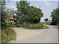
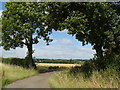
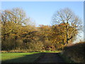
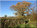
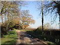
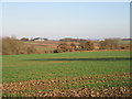
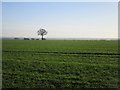
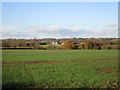
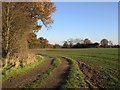
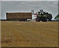
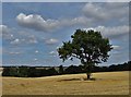
Dover Beck Ward occupies a significant portion of the East Midlands, covering an area of 50.4 square kilometres. This district borough unitary ward lies within Newark and Sherwood District in Nottinghamshire. The location sits near the River Trent, encompassing rural parishes such as Oxton, Epperstone, Thurgarton and Staythorpe. You will find the ward situated approximately at coordinates 53.0389°N, -1.0124°W. Living in Dover Beck Ward means navigating a landscape defined by these specific rural settlements rather than dense urban centres. The geography shapes the daily routine for residents who rely on the network connecting these scattered communities. The ward functions as a distinct administrative unit with a clear boundary map available since May 2015. This structure influences how local services are delivered and how elections are organised. The combination of rural parishes creates a living environment that differs from neighbouring more urbanised districts. Prospective buyers need to understand that Dover Beck Ward is not a single town but a collection of villages and open land. This context is essential for anyone considering homes in this area. The specific coordinate location places you firmly within the East Midlands region, offering a setting that blends agricultural history with modern residential needs.
- Area Type
- District Borough Unitary Ward
- Area Size
- 50.4 km²
- Population
- Not available
- Population Density
- Not available
Demographics
The community profile for Dover Beck Ward reveals a largely settled population. Statistics show a median age of 70 years across the ward. This figure distinguishes the area as having an older demographic than many other parts of the country. You can expect to find retirees and long-term residents forming the backbone of the local society. Households in Dover Beck Ward reflect this age profile, with care needs and social activities likely centring on community provisions suitable for older adults. Home ownership stands at an impressive 86% of total households within the ward boundaries. This high rate indicates that most people living in Dover Beck Ward own their properties outright or with a significant equity share. The data confirms that this is predominantly an owner-occupied area rather than a rental market. Accommodation types vary, but the high ownership rate suggests stability within the local community. While specific figures for ethnic diversity and religious affiliation are not broken out in the reports, the dominance of older home ownership points to a consistent societal structure over many decades. For residents, this means a neighbourhood where property values and tenure statuses remain reliable.
Household Size
Accommodation Type
Tenure
Ethnic Group
Religion
Household Composition
Age
Household Deprivation
NS-SEC
Explore more demographic insights in this area
Go to Demographics tabPlanning
Planning Constraints
- Flood RiskPremium
- Ramsar Wetland SitesPremium
- Area of Outstanding Natural BeautyPremium
- Protected Nature ReservePremium
- Protected WoodlandPremium
- Crime RiskPremium