Area Overview for Donington, Quadring and Gosberton Ward
Photos of Donington, Quadring and Gosberton Ward


Area Information
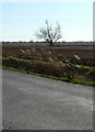
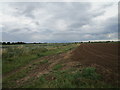
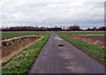
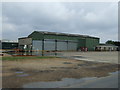
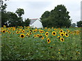
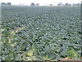
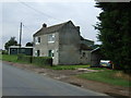
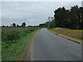
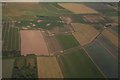
Donington, Quadring and Gosberton Ward sits within the South Holland District of Lincolnshire, covering an expanse of 74.8 km². This electoral ward encompasses the villages of Donington, Quadring, and Gosberton, placing it roughly 8 miles north of Spalding and 11 miles south of Boston in the East Midlands. At the 2021 census, the population stood at 3,196 residents. The area sits within the fenland drainage area managed by the Black Sluice Internal Drainage Board. Historical roots run deep, with Roman roads passing through Donington and Saxon influences visible in local place names like Gosberton. Quairing derives its name from Old English meaning a muddy settlement. Ancient trees and churches stand as testaments to the region's long history. Donington features a Grade I listed Church of St Mary and the Holy Rood, while Gosberton hosts its own parish church alongside St Gilbert and St Hugh in Gosberton Clough. Life here involves navigating the A152 and A52, which offer access to wider networks. The A52 bypass opened in 1989, improving traffic flow through the ward. A former railway line still passes through Risegate. Living in Donington, Quadring and Gosberton Ward means relying on these established transport links and enjoying a setting defined by its agricultural past and rural character rather than urban development.
- Area Type
- District Borough Unitary Ward
- Area Size
- 74.8 km²
- Population
- Not available
- Population Density
- Not available
Demographics
The community within Donington, Quadring and Gosberton Ward displays a distinctly older demographic profile. The median age across the ward is 70 years, indicating a significant proportion of elderly residents. Data regarding the most common age range in the ward is recorded as 'Total', suggesting a broad distribution without a single dominant youth or adult cohort. This age structure often correlates with specific lifestyle needs and service requirements for the area. Home ownership is the dominant living arrangement, with 77% of households owning their property. This high rate suggests stability and long-term settlement within the villages. The ward comprises several distinct accommodation types, though specific breakdowns by property style are not detailed in available records. Ethnic diversity and religious composition are recorded as 'Total' across the ward, reflecting a catalogue of varied backgrounds rather than a single homogeneous group. Household composition data is similarly categorised as 'Total', meaning the mix of family units, single-person homes, and multi-generational living varies. For those considering living in Donington, Quadring and Gosberton Ward, the static nature of the demographic data points towards a settled community where residents often stay for life. The area does not fit a transient or rapidly shifting population model.
Household Size
Accommodation Type
Tenure
Ethnic Group
Religion
Household Composition
Age
Household Deprivation
NS-SEC
Explore more demographic insights in this area
Go to Demographics tabPlanning
Planning Constraints
- Flood RiskPremium
- Ramsar Wetland SitesPremium
- Area of Outstanding Natural BeautyPremium
- Protected Nature ReservePremium
- Protected WoodlandPremium
- Crime RiskPremium