Area Overview for Dodford
Photos of Dodford


Area Information
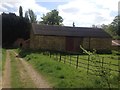
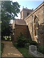
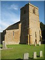
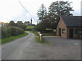
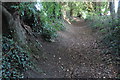
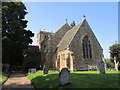
Dodford is a civil parish located in England, covering an area of 5.9 km². This small geographical footprint defines a close-knit environment where daily life moves at a deliberate pace. The parish offers a distinct character without the congestion found in larger urban centres. Residents here experience a lifestyle defined by space and local familiarity rather than high-rise density or rapid urban expansion. Living in Dodford means navigating a compact community where neighbours know each other and the scale of the settlement remains manageable. The area functions as a traditional settlement within its broader county context. You will find that the physical layout supports quiet domestic living rather than commercial bustle. This parish is not a large city borough but a focused rural outpost. Its size ensures that distance between homes and local amenities remains short. Walking distances are generally practical for daily necessities. The specific boundaries of this 5.9 sq km region create a self-contained pocket of village life. Prospective buyers should understand that their new home sits within these precise limits, offering a clear picture of what the neighbourhood entails before purchasing.
- Area Type
- Parish
- Area Size
- 5.9 km²
- Population
- Not available
- Population Density
- Not available
Demographics
The community in Dodford carries an unmistakable demographic signature with a median age of 70 years. This figure indicates a population heavily weighted towards older residents who likely value stability over rapid change. Most household data falls under a total category classification, reflecting the aggregated nature of the current census details available for this parish. Home ownership stands at 85%, a figure that highlights the area as an established homeowner community rather than a rental market. You will encounter few transient families or student populations in this setting. The age profile suggests that living in Dodford appeals primarily to those seeking retirement or a quiet later-life settlement. The high ownership rate reinforces this trend, showing that families typically settle here with the intention of staying long-term. Accommodation types remain categorised generally in the available records, though the ownership statistic implies a stock dominated by privately owned properties rather than council housing. Diversity data is aggregated into totals, pointing to a homogenous demographic structure typical of many rural settlements. If you seek an environment where the majority of your neighbours are seniors, this parish aligns with that demographic reality.
Household Size
Accommodation Type
Tenure
Ethnic Group
Religion
Household Composition
Age
Household Deprivation
NS-SEC
Explore more demographic insights in this area
Go to Demographics tabPlanning
Planning Constraints
- Flood RiskLocked
- Ramsar Wetland SitesLocked
- Area of Outstanding Natural BeautyLocked
- Protected Nature ReserveLocked
- Protected WoodlandLocked
- Crime RiskLocked