Area Overview for DN38 6AY
Photos of DN38 6AY
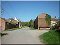
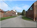
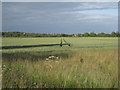
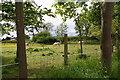
6 photos from this area
Area Information
Key information about the DN38 6AY including its size, population, and administrative classification.
- Area Type
- Postcode
- Area Size
- 92.3 hectares
- Population
- 2676
- Population Density
- 34 people/km²
House Prices in DN38 6AY
20
Properties
£295,286
Average Sold Price
£95,000
Lowest Price
£560,000
Highest Price
Showing 20 properties
| Address | Type | Beds | Baths | Last Sale Price | Last Sale Date | |
|---|---|---|---|---|---|---|
| Coppice House, Owmby Hill, Owmby, Barnetby, DN38 6AY | house | - | - | £560,000 | Sep 2022 | |
| Whimbrel, Owmby Hill, Owmby, Barnetby, DN38 6AY | Bungalow | - | - | £247,500 | Oct 2020 | |
| The White House, Wold View, Owmby, Barnetby, DN38 6AY | Detached | 4 | - | £282,500 | Aug 2013 | |
| Anfield House, Wold View, Owmby, Barnetby, DN38 6AY | house | - | - | £410,000 | Feb 2013 | |
| Tithe House, Owmby Hill, Owmby, Barnetby, DN38 6AY | Detached | - | - | £322,000 | Jul 2004 | |
| Ivy House, Owmby Hill, Owmby, Barnetby, DN38 6AY | Detached | - | - | £150,000 | Jun 2000 | |
| Viking House, Owmby Hill, Owmby, Barnetby, DN38 6AY | Detached | - | - | £95,000 | Apr 1995 | |
| THE BUNGALOW, MANOR FARM, WOLD VIEW, Owmby, Barnetby, DN38 6AY | Bungalow | - | - | - | - | |
| Pendennis, Owmby Hill, Owmby, Barnetby, DN38 6AY | Detached | - | - | - | - | |
| 4 Wold View, Owmby, Barnetby, DN38 6AY | Semi-detached | - | - | - | - |
Page 1 of 2
Energy Efficiency in DN38 6AY
Amenities
Schools
| Rank | School | Type | Entry gender | Ages |
|---|
Explore more schools in this area
Go to Schools tabDemographics
Household Size
Two person
most common
Accommodation Type
Houses
most common
Tenure
82
majority
Ethnic Group
White
most common
Religion
N/A
most common
Household Composition
N/A
most common
Age
47
median
Adults (30-64 years)
most common
Household Deprivation
N/A
with no deprivation
NS-SEC
39
in Lower managerial occupations
Explore more demographic insights in this area
Go to Demographics tabPlanning
Planning Constraints
- Flood RiskPremium
- Ramsar Wetland SitesPremium
- Area of Outstanding Natural BeautyPremium
- Protected Nature ReservePremium
- Protected WoodlandPremium