Area Overview for DN37 8NE
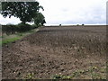
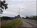
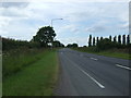
Photos of DN37 8NE


Area Information
Living in DN37 8NE means being part of a small, low-density residential cluster in England, covering 83.2 hectares and home to 2,226 people. The area’s compact size fosters a quiet, community-oriented atmosphere, with a population density of just 64 people per square kilometre. This makes it an appealing choice for those seeking a peaceful, less congested environment. The mix of local amenities, including schools, rail links, and retail options, ensures daily life is convenient without the pressures of urban density. With no major environmental constraints or planning restrictions, DN37 8NE offers a straightforward, practical living experience. Its proximity to rail stations and nearby airports enhances connectivity, while the low crime risk score of 80/100 suggests a safe, stable neighbourhood. For buyers prioritising security, space, and simplicity, this area provides a clear, uncluttered alternative to larger towns or cities.
- Area Type
- Postcode
- Area Size
- 83.2 hectares
- Population
- 2226
- Population Density
- 64 people/km²
The property market in DN37 8NE is dominated by owner-occupied homes, with 75% of properties in private hands. This reflects a community where long-term residency is common, rather than a rental-heavy market. The accommodation type is primarily houses, which suits the area’s low-density, residential nature. Given the small size of the postcode area, the housing stock is likely limited to individual properties rather than larger developments. For buyers, this means a focus on single-family homes with potential for personalisation. However, the lack of commercial or mixed-use properties suggests that investment opportunities may be limited to residential purchases. The absence of significant planning constraints also means properties are likely free from restrictions that could complicate sales or renovations.
House Prices in DN37 8NE
Showing 1 properties
| Address | Type | Beds | Baths | Last Sale Price | Last Sale Date | |
|---|---|---|---|---|---|---|
| Riby Dene, Barton Street, Riby, Grimsby, DN37 8NE | house | 4 | - | £305,000 | Sep 2019 |
Energy Efficiency in DN37 8NE
The lifestyle in DN37 8NE is shaped by its proximity to essential amenities. Five retail outlets, including Lincolnshire Co-operative Co and Spar, provide everyday shopping needs. Rail stations like Stallingborough and Habrough connect residents to nearby towns, while Humberside Airport offers broader travel options. The area’s small size means amenities are within practical reach, fostering a sense of convenience. Though the data does not mention parks or leisure facilities, the absence of environmental restrictions suggests open spaces may be available nearby. The combination of retail, transport, and connectivity creates a lifestyle that prioritises ease of access without the clutter of larger urban areas. For those valuing simplicity and practicality, DN37 8NE offers a straightforward, functional living experience.
Amenities
Schools
Residents of DN37 8NE have access to two primary schools: Keelby Primary School and Keelby Primary Academy. Both institutions serve the local community, providing early education for children in the area. The presence of two primary schools within practical reach offers convenience for families, though no secondary schools are listed in the data. This means parents may need to look beyond the immediate postcode for secondary education. The availability of primary schooling is a key factor for families prioritising proximity to educational facilities. While the data does not include Ofsted ratings, the presence of two schools suggests a focus on local educational provision, which can be a strong selling point for buyers with children.
| Rank | School | Type | Entry gender | Ages |
|---|
Explore more schools in this area
Go to Schools tabDemographics
DN37 8NE has a median age of 47, with the majority of residents aged between 30 and 64. This suggests a mature, established community with a focus on stability. Home ownership is high, at 75%, indicating that most residents are long-term residents rather than renters. The accommodation type is predominantly houses, which aligns with the area’s low-density layout. The predominant ethnic group is White, and while no specific data on diversity or deprivation is provided, the age profile and home ownership figures imply a relatively affluent, settled population. The low population density of 64 people per square kilometre further supports the idea of a quiet, spacious living environment. For those seeking a community with a balance of privacy and accessibility, DN37 8NE’s demographic profile offers a clear picture of its character.
Household Size
Accommodation Type
Tenure
Ethnic Group
Religion
Household Composition
Age
Household Deprivation
NS-SEC
Explore more demographic insights in this area
Go to Demographics tabPlanning
Planning Constraints
- Flood RiskPremium
- Ramsar Wetland SitesPremium
- Area of Outstanding Natural BeautyPremium
- Protected Nature ReservePremium
- Protected WoodlandPremium