Area Overview for DN36 5ZQ
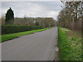
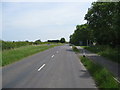
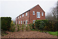
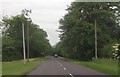
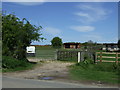
Photos of DN36 5ZQ


Area Information
Living in DN36 5ZQ offers a quiet, small-scale residential experience in a low-density area with a population of 1,302. The postcode covers a compact cluster of homes, ideal for those seeking a slower pace of life. The community is predominantly composed of adults aged 30–64, with a median age of 47, suggesting a stable, established population. Home ownership is high at 83%, indicating a strong sense of local attachment. Daily life is shaped by proximity to essential services, including retail outlets like Spar and Morrisons, and rail connections to Cleethorpes, Grimsby Town, and New Clee stations. The area’s low crime risk—scoring 85 out of 100 for safety—adds to its appeal. Families benefit from The North Cotes Church of England Primary School, rated ‘good’ by Ofsted. While the area is small, its practical amenities and safety profile make it a viable choice for buyers prioritising security and convenience over urban vibrancy.
- Area Type
- Postcode
- Area Size
- Not available
- Population
- 1302
- Population Density
- 38 people/km²
The property market in DN36 5ZQ is characterised by high home ownership—83% of residents own their homes—suggesting a stable, long-term demographic. The accommodation type is predominantly houses, which are more common than flats or other formats. This reflects a market skewed toward owner-occupation rather than rental, with limited turnover of properties. The small size of the area means the housing stock is finite, and buyers may need to consider nearby postcode areas for more options. The prevalence of houses implies larger properties, which may appeal to families or those seeking space. However, the limited scale of the area could mean fewer choices for buyers, requiring a broader search beyond DN36 5ZQ itself. The market’s stability is reinforced by the low crime risk and practical amenities, making it attractive for those prioritising security and established living.
House Prices in DN36 5ZQ
No properties found in this postcode.
Energy Efficiency in DN36 5ZQ
The lifestyle in DN36 5ZQ is shaped by its small-scale amenities and proximity to essential services. Retail options include Spar, Lincolnshire Co-operative Co-op Holton Le Clay, and Morrisons Daily, offering convenience for groceries and daily needs. The rail stations—Cleethorpes, Grimsby Town, and New Clee—provide access to broader regional networks, supporting both leisure and commuting. While the area lacks detailed information on parks or leisure facilities, the presence of multiple retail outlets and rail links suggests a practical, community-focused approach to daily living. The low population density and quiet environment may appeal to those seeking a relaxed lifestyle, with limited noise and congestion. The combination of local shops and transport links ensures residents can meet most needs without long journeys, fostering a self-contained yet connected way of life.
Amenities
Schools
The North Cotes Church of England Primary School is the primary educational institution within reach of DN36 5ZQ, serving young children in the area. Rated ‘good’ by Ofsted, it provides a reliable foundation for early education. As the only school explicitly listed in the data, it underscores the area’s suitability for families with young children. The absence of secondary schools or other educational institutions means parents may need to look beyond the immediate postcode for comprehensive schooling. However, the proximity of this primary school reduces daily commuting for families, supporting a community-focused approach to education. The school’s rating indicates a standard of teaching and facilities that meet acceptable benchmarks, though no data on pupil outcomes or additional amenities is provided.
| Rank | School | Type | Entry gender | Ages |
|---|
Explore more schools in this area
Go to Schools tabDemographics
DN36 5ZQ’s population of 1,302 is spread across 38 people per square kilometre, reflecting a low-density, residential-focused layout. The median age of 47 indicates a mature community, with 83% of residents owning their homes. This high home ownership rate suggests a long-term presence of households, many of which are likely multi-generational or family-based. The predominant accommodation type is houses, aligning with the area’s character as a small, settled cluster. The population is predominantly White, with no specific data on other ethnic groups. The age profile—skewing toward adults aged 30–64—implies a community with established careers and family structures, which may influence local services and amenities. The absence of detailed diversity statistics means the demographic composition remains largely homogeneous, with no explicit indicators of deprivation or socioeconomic challenges.
Household Size
Accommodation Type
Tenure
Ethnic Group
Religion
Household Composition
Age
Household Deprivation
NS-SEC
Explore more demographic insights in this area
Go to Demographics tabPlanning
Planning Constraints
- Flood RiskPremium
- Ramsar Wetland SitesPremium
- Area of Outstanding Natural BeautyPremium
- Protected Nature ReservePremium
- Protected WoodlandPremium