Area Overview for DN36 5AS
Photos of DN36 5AS
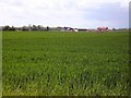

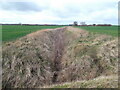
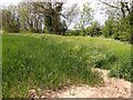
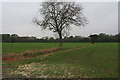
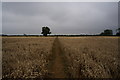
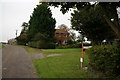
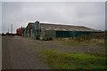
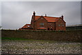


16 photos from this area
Area Information
Key information about the DN36 5AS including its size, population, and administrative classification.
- Area Type
- Postcode
- Area Size
- 1.4 km²
- Population
- 1120
- Population Density
- 543 people/km²
House Prices in DN36 5AS
36
Properties
£282,321
Average Sold Price
£105,000
Lowest Price
£420,000
Highest Price
Showing 36 properties
| Address | Type | Beds | Baths | Last Sale Price | Last Sale Date | |
|---|---|---|---|---|---|---|
| 29 Tetney Lane, Holton Le Clay, DN36 5AS | Bungalow | 4 | 1 | £240,000 | Apr 2024 | |
| 17 Tetney Lane, Holton Le Clay, DN36 5AS | house | - | - | £300,000 | Sep 2022 | |
| 19 Tetney Lane, Holton Le Clay, DN36 5AS | Bungalow | - | - | £420,000 | Jun 2022 | |
| 11A Tetney Lane, Holton Le Clay, DN36 5AS | Bungalow | - | - | £415,000 | Jun 2021 | |
| 31 Tetney Lane, Holton Le Clay, DN36 5AS | Bungalow | - | - | £180,000 | Feb 2021 | |
| 49 Tetney Lane, Holton Le Clay, DN36 5AS | Terraced | 3 | 1 | £165,000 | Nov 2020 | |
| 33 Tetney Lane, Holton Le Clay, DN36 5AS | Bungalow | 4 | 2 | £350,000 | Mar 2019 | |
| 43 Tetney Lane, Holton Le Clay, DN36 5AS | Detached | 3 | 1 | £210,000 | Feb 2019 | |
| Eastfield Farm, Tetney Lane, Holton Le Clay, DN36 5AS | house | - | - | £275,000 | Jul 2018 | |
| 35 Tetney Lane, Holton Le Clay, DN36 5AS | house | - | - | £415,000 | Jul 2018 |
Page 1 of 4
Energy Efficiency in DN36 5AS
Amenities
Schools
| Rank | School | Type | Entry gender | Ages |
|---|
Explore more schools in this area
Go to Schools tabDemographics
Household Size
Two person
most common
Accommodation Type
Houses
most common
Tenure
91
majority
Ethnic Group
White
most common
Religion
N/A
most common
Household Composition
N/A
most common
Age
47
median
Adults (30-64 years)
most common
Household Deprivation
N/A
with no deprivation
NS-SEC
31
in Lower managerial occupations
Explore more demographic insights in this area
Go to Demographics tabPlanning
Planning Constraints
- Flood RiskPremium
- Ramsar Wetland SitesPremium
- Area of Outstanding Natural BeautyPremium
- Protected Nature ReservePremium
- Protected WoodlandPremium