Area Overview for DN22 8SZ
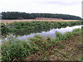
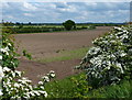
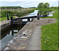
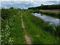
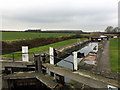
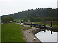
Photos of DN22 8SZ


Area Information
DN22 8SZ is a small, residential postcode area in England, home to 2,898 people spread across a low-density landscape. Its compact size and modest population suggest a quiet, close-knit community, likely centred around family homes and local amenities. The area’s character is defined by its proximity to nearby towns and its blend of practical living with access to essential services. With a median age of 47 and a population skewed toward adults aged 30–64, it caters to established families and professionals. Daily life here is likely shaped by the surrounding infrastructure, including nearby schools, retail hubs, and transport links. While the area lacks large-scale developments, its small footprint ensures a manageable, low-traffic environment. Residents benefit from a balance between rural tranquillity and the convenience of nearby urban centres, making DN22 8SZ a viable option for those seeking a settled, community-focused lifestyle without the pressures of dense urban living.
- Area Type
- Postcode
- Area Size
- Not available
- Population
- 2898
- Population Density
- 58 people/km²
The property market in DN22 8SZ is characterised by a high rate of home ownership—78%—indicating a strong presence of owner-occupied homes. The accommodation type is predominantly houses, which aligns with the area’s low population density and suburban layout. This suggests a market skewed toward family homes rather than apartments or rental properties. Given the small size of the postcode area, the housing stock is likely limited, which could mean a niche market with fewer options for buyers. The focus on houses may appeal to those seeking space and privacy, though the lack of data on property prices or recent transactions makes it difficult to assess market trends. Buyers should consider the area’s proximity to amenities and transport links, which may enhance its appeal despite its modest scale.
House Prices in DN22 8SZ
No properties found in this postcode.
Energy Efficiency in DN22 8SZ
The lifestyle in DN22 8SZ is shaped by its proximity to retail, transport, and community hubs. Nearby shops include Asda Retford, Lincolnshire Co-operative Co, and Morrisons Welham, offering a range of shopping options. The area’s rail stations connect residents to broader networks, while Retford Gamston Airport provides a minor aviation link. Though the postcode itself is small, its immediate surroundings likely include parks or green spaces, though no specific names are listed. The mix of retail and transport options suggests a practical, convenience-driven lifestyle. Residents can access daily essentials without long commutes, and the rail links support both local and regional travel. The absence of detailed data on leisure facilities means the area’s character is defined more by its functional amenities than cultural or recreational offerings.
Amenities
Schools
Residents of DN22 8SZ have access to a range of schools, including Ranby CofE Primary School and Sutton-Cum-Lound CofE School, both rated ‘good’ by Ofsted. These state-funded primary schools provide a solid foundation for local children. For independent education, Worksop College Preparatory School, Ranby House, offers an alternative with a focus on private schooling. The mix of school types ensures families can choose between state and independent options, catering to different preferences and budgets. The presence of two ‘good’-rated primary schools suggests a commitment to education quality in the area. However, no secondary schools are listed, so parents may need to consider nearby towns for secondary education. This combination of school types reflects a balanced approach to education accessibility for the community.
| Rank | School | Type | Entry gender | Ages |
|---|
Explore more schools in this area
Go to Schools tabDemographics
The population of DN22 8SZ is predominantly adults aged 30–64, with a median age of 47. This suggests a community of established professionals and families, rather than a younger, student-driven demographic. Home ownership is high at 78%, indicating a stable, long-term resident base. The accommodation type is primarily houses, which aligns with the area’s low population density and suburban character. The predominant ethnic group is White, though no specific data on diversity or deprivation levels is provided. The age profile implies a mature population, which may influence local services and amenities. With no data on income distribution or deprivation, it is unclear how economic factors shape quality of life. However, the high home ownership rate and focus on family homes suggest a community prioritising stability over transient living.
Household Size
Accommodation Type
Tenure
Ethnic Group
Religion
Household Composition
Age
Household Deprivation
NS-SEC
Explore more demographic insights in this area
Go to Demographics tabPlanning
Planning Constraints
- Flood RiskPremium
- Ramsar Wetland SitesPremium
- Area of Outstanding Natural BeautyPremium
- Protected Nature ReservePremium
- Protected WoodlandPremium