Area Overview for DN22 8RX
Photos of DN22 8RX
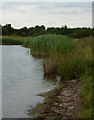
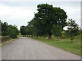
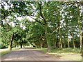
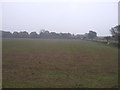
29 photos from this area
Area Information
Key information about the DN22 8RX including its size, population, and administrative classification.
- Area Type
- Postcode
- Area Size
- 9.2 hectares
- Population
- 2898
- Population Density
- 58 people/km²
House Prices in DN22 8RX
22
Properties
£465,538
Average Sold Price
£58,000
Lowest Price
£3,500,000
Highest Price
Showing 22 properties
| Address | Type | Beds | Baths | Last Sale Price | Last Sale Date | |
|---|---|---|---|---|---|---|
| Lound Hall Care Home, Town Street, Lound, DN22 8RX | Retirement | - | - | £3,500,000 | Nov 2021 | |
| 90 Town Street, Lound, DN22 8RX | house | - | - | £475,000 | Mar 2021 | |
| 99 Town Street, Lound, DN22 8RX | Detached | 4 | 2 | £420,000 | Jun 2019 | |
| East Field House, 101A Town Street, Lound, DN22 8RX | Detached | 5 | 2 | £308,000 | Jan 2016 | |
| 92 Town Street, Lound, DN22 8RX | house | - | - | £320,000 | Apr 2010 | |
| 79 Town Street, Lound, DN22 8RX | Detached | - | - | £175,000 | Nov 2002 | |
| Ryecroft, 93 Town Street, Lound, DN22 8RX | Detached | - | - | £265,000 | Aug 2002 | |
| 84 Town Street, Lound, DN22 8RX | Detached | 5 | 2 | £81,038 | Apr 2000 | |
| Lound Cottage, 77 Town Street, Lound, DN22 8RX | Detached | - | - | £140,000 | Mar 2000 | |
| 86 Town Street, Lound, DN22 8RX | Detached | - | - | £79,950 | Dec 1999 |
Page 1 of 3
Energy Efficiency in DN22 8RX
Amenities
Schools
| Rank | School | Type | Entry gender | Ages |
|---|
Explore more schools in this area
Go to Schools tabDemographics
Household Size
Two person
most common
Accommodation Type
Houses
most common
Tenure
78
majority
Ethnic Group
White
most common
Religion
N/A
most common
Household Composition
N/A
most common
Age
47
median
Adults (30-64 years)
most common
Household Deprivation
N/A
with no deprivation
NS-SEC
29
in Lower managerial occupations
Explore more demographic insights in this area
Go to Demographics tabPlanning
Planning Constraints
- Flood RiskPremium
- Ramsar Wetland SitesPremium
- Area of Outstanding Natural BeautyPremium
- Protected Nature ReservePremium
- Protected WoodlandPremium