Area Overview for DN22 8PY
Photos of DN22 8PY


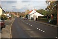


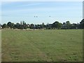

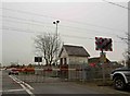
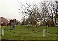
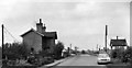
16 photos from this area
Area Information
Key information about the DN22 8PY including its size, population, and administrative classification.
- Area Type
- Postcode
- Area Size
- 41.6 hectares
- Population
- 2898
- Population Density
- 58 people/km²
House Prices in DN22 8PY
37
Properties
£274,702
Average Sold Price
£80,000
Lowest Price
£580,000
Highest Price
Showing 37 properties
| Address | Type | Beds | Baths | Last Sale Price | Last Sale Date | |
|---|---|---|---|---|---|---|
| 35 Sutton Lane, Sutton Cum Lound, DN22 8PY | Detached | 4 | 2 | £447,000 | Oct 2023 | |
| Ashcroft Bungalow, 16 Sutton Lane, Sutton Cum Lound, DN22 8PY | Bungalow | 4 | 1 | £365,000 | May 2022 | |
| Homelands, 8 Sutton Lane, Sutton Cum Lound, DN22 8PY | house | - | - | £365,099 | Aug 2021 | |
| 19 Sutton Lane, Sutton Cum Lound, DN22 8PY | Bungalow | - | - | £265,000 | Jun 2021 | |
| 27 Sutton Lane, Sutton Cum Lound, DN22 8PY | Bungalow | 3 | 1 | £240,000 | Dec 2020 | |
| Stanway, 11 Sutton Lane, Sutton Cum Lound, DN22 8PY | Detached | 4 | 3 | £580,000 | Dec 2020 | |
| Lomond, 5 Sutton Lane, Sutton Cum Lound, DN22 8PY | Bungalow | 2 | 1 | £270,000 | Jan 2020 | |
| 6 Sutton Lane, Sutton Cum Lound, DN22 8PY | Bungalow | 3 | 1 | £190,000 | Dec 2017 | |
| Clevelands, 29 Sutton Lane, Sutton Cum Lound, DN22 8PY | Bungalow | 3 | 1 | £195,000 | Nov 2016 | |
| Greystones, 31 Sutton Lane, Sutton Cum Lound, DN22 8PY | Bungalow | 3 | 1 | £310,000 | Sep 2016 |
Page 1 of 4
Energy Efficiency in DN22 8PY
Amenities
Schools
| Rank | School | Type | Entry gender | Ages |
|---|
Explore more schools in this area
Go to Schools tabDemographics
Household Size
Two person
most common
Accommodation Type
Houses
most common
Tenure
78
majority
Ethnic Group
White
most common
Religion
N/A
most common
Household Composition
N/A
most common
Age
47
median
Adults (30-64 years)
most common
Household Deprivation
N/A
with no deprivation
NS-SEC
29
in Lower managerial occupations
Explore more demographic insights in this area
Go to Demographics tabPlanning
Planning Constraints
- Flood RiskPremium
- Ramsar Wetland SitesPremium
- Area of Outstanding Natural BeautyPremium
- Protected Nature ReservePremium
- Protected WoodlandPremium