Area Overview for DN22 8AR
Photos of DN22 8AR
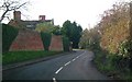
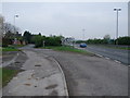
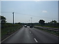
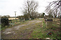
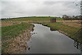
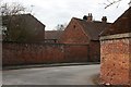
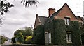
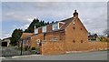
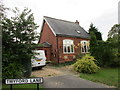
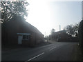
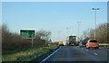

41 photos from this area
Area Information
Key information about the DN22 8AR including its size, population, and administrative classification.
- Area Type
- Postcode
- Area Size
- 7.5 hectares
- Population
- 1994
- Population Density
- 29 people/km²
House Prices in DN22 8AR
20
Properties
£236,050
Average Sold Price
£110,000
Lowest Price
£495,000
Highest Price
Showing 20 properties
| Address | Type | Beds | Baths | Last Sale Price | Last Sale Date | |
|---|---|---|---|---|---|---|
| 7 Park Lane, Elkesley, DN22 8AR | Terraced | 1 | 1 | £176,500 | Jul 2024 | |
| 10 PARK LANE, Elkesley, DN22 8AR | Detached | 1 | 1 | £230,000 | Dec 2022 | |
| Corner Cottage, 1 Park Lane, Elkesley, DN22 8AR | Bungalow | 3 | 1 | £195,000 | Feb 2021 | |
| 14 Park Lane, Elkesley, DN22 8AR | Detached | 3 | 1 | £495,000 | Dec 2018 | |
| Honeysuckle Cottage, 9 Park Lane, Elkesley, DN22 8AR | Detached | 3 | 1 | £263,000 | Jul 2017 | |
| The Bungalow, 2 Park Lane, Elkesley, DN22 8AR | Bungalow | 1 | 1 | £170,000 | Mar 2017 | |
| South View, Park Lane, Elkesley, DN22 8AR | house | 4 | - | £296,000 | Dec 2011 | |
| Haughton View, Park Lane, Elkesley, DN22 8AR | house | - | - | £305,000 | Sep 2009 | |
| Bourne Cottage, 6 Park Lane, Elkesley, DN22 8AR | house | - | - | £110,000 | Oct 2005 | |
| 12 Park Lane, Elkesley, DN22 8AR | Cottage | 2 | 1 | £120,000 | Sep 2004 |
Page 1 of 2
Energy Efficiency in DN22 8AR
Amenities
Schools
| Rank | School | Type | Entry gender | Ages |
|---|
Explore more schools in this area
Go to Schools tabDemographics
Household Size
Two person
most common
Accommodation Type
Houses
most common
Tenure
54
majority
Ethnic Group
White
most common
Religion
N/A
most common
Household Composition
N/A
most common
Age
47
median
Adults (30-64 years)
most common
Household Deprivation
N/A
with no deprivation
NS-SEC
29
in Lower managerial occupations
Explore more demographic insights in this area
Go to Demographics tabPlanning
Planning Constraints
- Flood RiskPremium
- Ramsar Wetland SitesPremium
- Area of Outstanding Natural BeautyPremium
- Protected Nature ReservePremium
- Protected WoodlandPremium