Area Overview for DN22 7JS
Photos of DN22 7JS
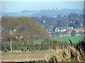
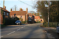
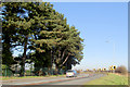
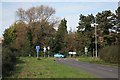
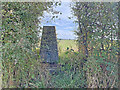
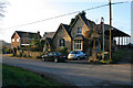
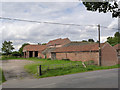
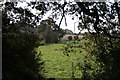
25 photos from this area
Area Information
Key information about the DN22 7JS including its size, population, and administrative classification.
- Area Type
- Postcode
- Area Size
- 2.8 hectares
- Population
- 1280
- Population Density
- 29 people/km²
House Prices in DN22 7JS
19
Properties
£125,032
Average Sold Price
£24,000
Lowest Price
£355,000
Highest Price
Showing 19 properties
| Address | Type | Beds | Baths | Last Sale Price | Last Sale Date | |
|---|---|---|---|---|---|---|
| 11 Allison Avenue, Retford, DN22 7JS | Semi-detached | 3 | 2 | £170,000 | Jun 2025 | |
| 9 Allison Avenue, Retford, DN22 7JS | Detached | 4 | 1 | £355,000 | May 2025 | |
| 18 Allison Avenue, Retford, DN22 7JS | Semi-detached | 2 | 1 | £125,000 | May 2024 | |
| 26 Allison Avenue, Retford, DN22 7JS | house | 3 | 2 | £215,000 | Dec 2022 | |
| 17 Allison Avenue, Retford, DN22 7JS | Semi-detached | 3 | - | £165,000 | Dec 2020 | |
| 20 Allison Avenue, Retford, DN22 7JS | Semi-detached | 2 | - | £113,000 | Mar 2016 | |
| 16 Allison Avenue, Retford, DN22 7JS | Semi-detached | 2 | 1 | £116,500 | Mar 2008 | |
| 24 Allison Avenue, Retford, DN22 7JS | Semi-detached | - | - | £125,000 | Sep 2007 | |
| 28 Allison Avenue, Retford, DN22 7JS | house | - | - | £108,000 | Aug 2006 | |
| 22 Allison Avenue, Retford, DN22 7JS | Semi-detached | - | - | £109,950 | May 2006 |
Page 1 of 2
Energy Efficiency in DN22 7JS
Amenities
Schools
| Rank | School | Type | Entry gender | Ages |
|---|
Explore more schools in this area
Go to Schools tabDemographics
Household Size
Two person
most common
Accommodation Type
Houses
most common
Tenure
74
majority
Ethnic Group
White
most common
Religion
N/A
most common
Household Composition
N/A
most common
Age
47
median
Adults (30-64 years)
most common
Household Deprivation
N/A
with no deprivation
NS-SEC
35
in Lower managerial occupations
Explore more demographic insights in this area
Go to Demographics tabPlanning
Planning Constraints
- Flood RiskPremium
- Ramsar Wetland SitesPremium
- Area of Outstanding Natural BeautyPremium
- Protected Nature ReservePremium
- Protected WoodlandPremium