Area Overview for DN22 6UA
Photos of DN22 6UA
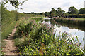
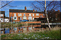
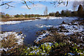
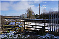
63 photos from this area
Area Information
Key information about the DN22 6UA including its size, population, and administrative classification.
- Area Type
- Postcode
- Area Size
- 1.1 hectares
- Population
- 1333
- Population Density
- 5923 people/km²
House Prices in DN22 6UA
46
Properties
£77,854
Average Sold Price
£22,000
Lowest Price
£160,000
Highest Price
Showing 46 properties
| Address | Type | Beds | Baths | Last Sale Price | Last Sale Date | |
|---|---|---|---|---|---|---|
| 59 Holdenby Close, Retford, DN22 6UA | Semi-detached | 3 | 1 | £155,000 | Sep 2025 | |
| 47 Holdenby Close, Retford, DN22 6UA | Terraced | 2 | 1 | £125,000 | Sep 2024 | |
| 73 Holdenby Close, Retford, DN22 6UA | Terraced | 2 | 1 | £125,000 | Jun 2024 | |
| 71 Holdenby Close, Retford, DN22 6UA | Semi-detached | 3 | 1 | £150,000 | May 2024 | |
| 91 Holdenby Close, Retford, DN22 6UA | Semi-detached | 2 | 1 | £128,000 | Feb 2024 | |
| 93 Holdenby Close, Retford, DN22 6UA | Semi-detached | - | - | £130,000 | Jun 2023 | |
| 17 Holdenby Close, Retford, DN22 6UA | Semi-detached | 2 | 1 | £75,000 | Dec 2021 | |
| 51 Holdenby Close, Retford, DN22 6UA | Terraced | 3 | 1 | £112,000 | Dec 2021 | |
| 19 Holdenby Close, Retford, DN22 6UA | Terraced | 2 | 1 | £110,000 | Jun 2021 | |
| 67 Holdenby Close, Retford, DN22 6UA | Detached | 3 | 1 | £160,000 | Dec 2020 |
Page 1 of 5
Energy Efficiency in DN22 6UA
Amenities
Schools
| Rank | School | Type | Entry gender | Ages |
|---|
Explore more schools in this area
Go to Schools tabDemographics
Household Size
Two person
most common
Accommodation Type
Houses
most common
Tenure
47
majority
Ethnic Group
White
most common
Religion
N/A
most common
Household Composition
N/A
most common
Age
47
median
Adults (30-64 years)
most common
Household Deprivation
N/A
with no deprivation
NS-SEC
17
in Lower managerial occupations
Explore more demographic insights in this area
Go to Demographics tabPlanning
Planning Constraints
- Flood RiskPremium
- Ramsar Wetland SitesPremium
- Area of Outstanding Natural BeautyPremium
- Protected Nature ReservePremium
- Protected WoodlandPremium