Area Overview for DN22 6ST
Photos of DN22 6ST
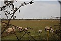
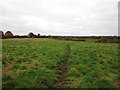
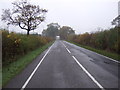
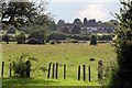
12 photos from this area
Area Information
Key information about the DN22 6ST including its size, population, and administrative classification.
- Area Type
- Postcode
- Area Size
- 4.0 hectares
- Population
- 1317
- Population Density
- 277 people/km²
House Prices in DN22 6ST
21
Properties
£218,782
Average Sold Price
£79,950
Lowest Price
£360,000
Highest Price
Showing 21 properties
| Address | Type | Beds | Baths | Last Sale Price | Last Sale Date | |
|---|---|---|---|---|---|---|
| 16 Durham Grove, Retford, DN22 6ST | Bungalow | 4 | 1 | £360,000 | Sep 2024 | |
| 14 Durham Grove, Retford, DN22 6ST | Bungalow | - | - | £232,500 | Jan 2024 | |
| 8 Durham Grove, Retford, DN22 6ST | Bungalow | 2 | 1 | £300,000 | Jul 2023 | |
| 3 Durham Grove, Retford, DN22 6ST | Detached | 4 | 3 | £255,000 | Nov 2022 | |
| 3A Durham Grove, Retford, DN22 6ST | Bungalow | - | - | £230,000 | Feb 2021 | |
| 7 Durham Grove, Retford, DN22 6ST | Bungalow | 2 | - | £220,000 | Nov 2019 | |
| 1 Durham Grove, Retford, DN22 6ST | Detached | 4 | 3 | £195,000 | May 2019 | |
| 5 Durham Grove, Retford, DN22 6ST | Bungalow | 3 | 2 | £245,000 | Sep 2017 | |
| 6 Durham Grove, Retford, DN22 6ST | Bungalow | 2 | 1 | £190,000 | Dec 2014 | |
| 2 Durham Grove, Retford, DN22 6ST | Detached | 2 | 2 | £188,000 | Oct 2012 |
Page 1 of 3
Energy Efficiency in DN22 6ST
Amenities
Schools
| Rank | School | Type | Entry gender | Ages |
|---|
Explore more schools in this area
Go to Schools tabDemographics
Household Size
Two person
most common
Accommodation Type
Houses
most common
Tenure
90
majority
Ethnic Group
White
most common
Religion
N/A
most common
Household Composition
N/A
most common
Age
47
median
Elderly (65+ years)
most common
Household Deprivation
N/A
with no deprivation
NS-SEC
36
in Lower managerial occupations
Explore more demographic insights in this area
Go to Demographics tabPlanning
Planning Constraints
- Flood RiskPremium
- Ramsar Wetland SitesPremium
- Area of Outstanding Natural BeautyPremium
- Protected Nature ReservePremium
- Protected WoodlandPremium