Area Overview for DN22 6SJ
Photos of DN22 6SJ
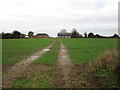
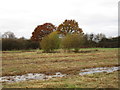
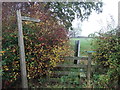
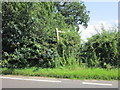
12 photos from this area
Area Information
Key information about the DN22 6SJ including its size, population, and administrative classification.
- Area Type
- Postcode
- Area Size
- 1.3 hectares
- Population
- 1317
- Population Density
- 277 people/km²
House Prices in DN22 6SJ
33
Properties
£151,546
Average Sold Price
£48,500
Lowest Price
£256,000
Highest Price
Showing 33 properties
| Address | Type | Beds | Baths | Last Sale Price | Last Sale Date | |
|---|---|---|---|---|---|---|
| 2 Richmond Road, Retford, DN22 6SJ | Semi-detached | 3 | 1 | £256,000 | Feb 2025 | |
| 4 Richmond Road, Retford, DN22 6SJ | house | - | - | £195,000 | May 2023 | |
| 14 Richmond Road, Retford, DN22 6SJ | house | 3 | 1 | £250,000 | Jun 2022 | |
| 34 Richmond Road, Retford, DN22 6SJ | house | - | - | £213,600 | Feb 2022 | |
| 16 Richmond Road, Retford, DN22 6SJ | house | - | - | £170,000 | Apr 2018 | |
| 6 Richmond Road, Retford, DN22 6SJ | house | - | - | £240,000 | Mar 2018 | |
| 20 Richmond Road, Retford, DN22 6SJ | Semi-detached | 3 | 1 | £185,000 | Dec 2017 | |
| 22 Richmond Road, Retford, DN22 6SJ | Semi-detached | 3 | 1 | £175,995 | Nov 2016 | |
| 21 Richmond Road, Retford, DN22 6SJ | house | - | - | £165,000 | Jun 2016 | |
| 25 Richmond Road, Retford, DN22 6SJ | house | 3 | - | £172,000 | Jun 2016 |
Page 1 of 4
Energy Efficiency in DN22 6SJ
Amenities
Schools
| Rank | School | Type | Entry gender | Ages |
|---|
Explore more schools in this area
Go to Schools tabDemographics
Household Size
Two person
most common
Accommodation Type
Houses
most common
Tenure
90
majority
Ethnic Group
White
most common
Religion
N/A
most common
Household Composition
N/A
most common
Age
47
median
Elderly (65+ years)
most common
Household Deprivation
N/A
with no deprivation
NS-SEC
36
in Lower managerial occupations
Explore more demographic insights in this area
Go to Demographics tabPlanning
Planning Constraints
- Flood RiskPremium
- Ramsar Wetland SitesPremium
- Area of Outstanding Natural BeautyPremium
- Protected Nature ReservePremium
- Protected WoodlandPremium