Area Overview for DN22 6NY
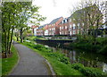
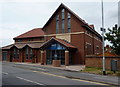
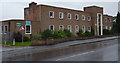
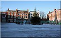
Photos of DN22 6NY


Area Information
Living in DN22 6NY means residing within a specific residential cluster defined by the postcode DN22 6NY in England. This small area covers just 206 square metres and supports a population of 1,781 people. Converts all that to density and you get 8630913 people per square kilometre, a figure that indicates an extremely concentrated urban environment. The terrain supports houses as the primary accommodation type within these tight boundaries. You are entering a settled neighbourhood where daily life revolves around proximity to transport hubs like Retford Railway Station and Retford Low Level Railway Station. An airport, Retford Gamston Airport, sits nearby for those requiring air travel. Supermarkets such as Spar, Morrisons Welham, and Iceland Retford form the backbone of local retail needs. This postcode represents a precise slice of life where space is defined by the postcode boundary rather than expansive suburban plots. You find a community centred on established houses rather than apartments or flats. The area functions as a distinct residential unit within the broader DN22 region, offering a defined commute route and specific local access points. Your everyday journey involves navigating these fixed locations where services and homes meet.
- Area Type
- Postcode
- Area Size
- 206 m²
- Population
- 1781
- Population Density
- 2738 people/km²
Housing in DN22 6NY is characterised by a stock dominated by houses rather than flats or apartments. Just 40 per cent of the 1,781 residents hold ownership of their properties. The remaining 60 per cent of the population rents their homes. This distribution suggests a balanced market where neither buy-to-let investors nor outright owners completely monopolise the residential landscape. You will find traditional detached or semi-detached structures fitting the house designation as the primary accommodation type. The specific postcode DN22 6NY commands a small residential cluster suitable for house purchasers and tenants alike. With 40 per cent ownership, the area supports a standard mix of owner-occupied single-family dwellings and privately rented accommodation. This split means you face competition from both first-time buyers seeking homes and established landlords managing properties. The size of the area at 206 square metres limits the total number of dwellings available on the market at any one time. High demand for these specific plots usually drives up competition for the available houses. You acquire security of tenure through purchase or temporary occupation through tenancy agreements within this constrained housing supply.
House Prices in DN22 6NY
No properties found in this postcode.
Energy Efficiency in DN22 6NY
Your daily lifestyle in DN22 6NY revolves around accessible everyday amenities located within practical reach. Retail options include Spar, Morrisons Welham, and Iceland Retford, providing essentials without needing extensive travel. You have access to two main railway stations: Retford Railway Station and Retford Low Level Railway Station for your commute or leisure journeys. Retford Gamston Airport sits nearby for aviation needs. These facilities form the core of your weekly routine. Shopping trips take advantage of the confirmed retail cluster containing five notable venues. Transport logistics simplify your week with two active rail termini and one airport nearby. You spend less time commuting to distant supermarkets or train stations. The presence of these specific names confirms a developed local infrastructure supporting residents of DN22 6NY. Your evenings and weekends likely involve visits to Retford or the immediate vicinity rather than long-distance trips to find basics. Convenience extends from your doorstep to the local shop or station entrance.
Amenities
Schools
| Rank | School | Type | Entry gender | Ages |
|---|
Explore more schools in this area
Go to Schools tabDemographics
The community in DN22 6NY is dominated by adults between the ages of 30 and 64 years. The median age stands at exactly 47 years, confirming that the demographic heart of this area lies firmly in mid-to-late adulthood. Forty percent of residents own their homes, leaving sixty percent in the rented sector. Houses serve as the lone predominant accommodation type for this population of 1,781 people. White residents form the predominantly ethnic group within this residential cluster. You do not find significant young family clusters below thirty or a large cohort of retirees over sixty-five defining the average age. The housing stock reflects the maturity of the occupants with a 40 per cent ownership rate. This age profile suggests a stable community composed of working professionals and established households. The concentration of adults correlates with the presence of immediate employment access or long-standing local roots. Your neighbours will likely share a similar life stage regarding career and family planning. The lack of children under ten or teenagers under sixteen often influences the quietness of the streets during daytime hours.
Household Size
Accommodation Type
Tenure
Ethnic Group
Religion
Household Composition
Age
Household Deprivation
NS-SEC
Explore more demographic insights in this area
Go to Demographics tabPlanning
Planning Constraints
- Flood RiskPremium
- Ramsar Wetland SitesPremium
- Area of Outstanding Natural BeautyPremium
- Protected Nature ReservePremium
- Protected WoodlandPremium