Area Overview for DN22 0ST
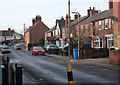
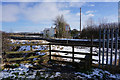
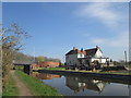
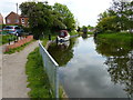
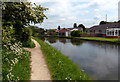
Photos of DN22 0ST


Area Information
Living in DN22 0ST means being part of a small, tightly knit residential cluster in England, where 1,317 people reside across an area with a population density of 277 people per square kilometre. This is a community defined by its compact nature, where daily life is shaped by proximity to essential services and a low population count. The area’s character is influenced by its demographic profile, with a median age of 47 and a significant proportion of residents aged 65 and over. This suggests a mature, stable population, many of whom own their homes—90% of properties are owner-occupied, with houses being the predominant accommodation type. DN22 0ST is not a sprawling suburb but a focused, residential enclave. Its small size means residents are likely to know their neighbours, and local amenities are within practical reach. The area’s low flood risk and absence of environmental constraints, such as protected woodlands or Ramsar sites, make it a straightforward place to live without complex planning restrictions. For those seeking a quiet, established community with minimal environmental disruption, DN22 0ST offers a clear appeal.
- Area Type
- Postcode
- Area Size
- Not available
- Population
- 1317
- Population Density
- 277 people/km²
The property market in DN22 0ST is dominated by owner-occupied homes, with 90% of properties being owned by residents rather than rented. This indicates a mature market where long-term residents are likely to have built equity in their homes. The accommodation type is exclusively houses, not flats or apartments, which is unusual for areas with higher population densities. This suggests a focus on single-family homes, possibly larger properties suited to the area’s older demographic. Given the small size of the area and its low population count, the housing stock is limited, which could mean fewer options for buyers but potentially higher demand for available properties. The absence of rental properties implies that the market is not driven by transient populations or student demand. For buyers, this means a niche market where properties are likely to be in good condition and well-maintained, with little competition from investors or landlords.
House Prices in DN22 0ST
No properties found in this postcode.
Energy Efficiency in DN22 0ST
Residents of DN22 0ST have access to a range of nearby amenities within practical reach. For shopping, the area is served by Spar, Morrisons Welham, and Iceland Retford, providing options for daily essentials and groceries. The presence of two railway stations—Retford Low Level and Retford Railway Station—offers easy access to regional travel, while Retford Gamston Airport provides additional transport flexibility. Although the area is small, these amenities collectively support a convenient lifestyle, allowing residents to manage errands, travel, and leisure without long commutes. The retail options cater to both routine needs and occasional shopping trips, ensuring that daily life remains efficient. The combination of local shops and transport links means that residents can balance quiet living with practical connectivity, making DN22 0ST a functional choice for those prioritising accessibility without sacrificing a peaceful environment.
Amenities
Schools
| Rank | School | Type | Entry gender | Ages |
|---|
Explore more schools in this area
Go to Schools tabDemographics
The community in DN22 0ST is predominantly elderly, with 65+ year-olds forming the most common age group. This is reflected in the median age of 47, which is higher than the national average, suggesting a population skewed towards older residents. Home ownership is exceptionally high at 90%, indicating a long-term presence of residents who have invested in their properties. The accommodation is almost exclusively houses, not flats or apartments, which aligns with the area’s small, residential character. The predominant ethnic group is White, which is consistent with broader regional trends. While no specific data on deprivation is provided, the high home ownership rate and low population density suggest a relatively stable, low-pressure environment. This demographic profile implies a community with established routines, fewer transient residents, and a focus on long-term living rather than short-term rental markets.
Household Size
Accommodation Type
Tenure
Ethnic Group
Religion
Household Composition
Age
Household Deprivation
NS-SEC
Explore more demographic insights in this area
Go to Demographics tabPlanning
Planning Constraints
- Flood RiskPremium
- Ramsar Wetland SitesPremium
- Area of Outstanding Natural BeautyPremium
- Protected Nature ReservePremium
- Protected WoodlandPremium