Area Overview for DN22 0JJ
Photos of DN22 0JJ
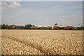

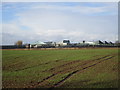
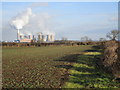

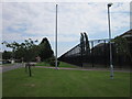
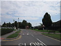
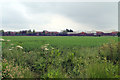
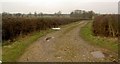
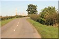

13 photos from this area
Area Information
Key information about the DN22 0JJ including its size, population, and administrative classification.
- Area Type
- Postcode
- Area Size
- 5.3 hectares
- Population
- 2295
- Population Density
- 53 people/km²
House Prices in DN22 0JJ
12
Properties
£262,919
Average Sold Price
£172,790
Lowest Price
£466,329
Highest Price
Showing 12 properties
| Address | Type | Beds | Baths | Last Sale Price | Last Sale Date | |
|---|---|---|---|---|---|---|
| 11 Galen Avenue, Woodbeck, DN22 0JJ | house | - | - | £172,790 | Jan 2022 | |
| Manyoaks, 7 Galen Avenue, Woodbeck, DN22 0JJ | house | - | - | £466,329 | Jun 2021 | |
| 10 Galen Avenue, Woodbeck, DN22 0JJ | house | - | - | £224,000 | May 2021 | |
| Wychwood, 8 Galen Avenue, Woodbeck, DN22 0JJ | house | - | - | £266,477 | May 2021 | |
| 5 Galen Avenue, Woodbeck, DN22 0JJ | house | 4 | - | £185,000 | Aug 2005 | |
| 12 Galen Avenue, Woodbeck, DN22 0JJ | house | 4 | 2 | - | - | |
| 4 Galen Avenue, Woodbeck, DN22 0JJ | Retail | 4 | 1 | - | - | |
| 1 Galen Avenue, Woodbeck, DN22 0JJ | Detached | - | - | - | - | |
| 3 Galen Avenue, Woodbeck, DN22 0JJ | house | - | - | - | - | |
| 2 Galen Avenue, Woodbeck, DN22 0JJ | house | - | - | - | - |
Page 1 of 2
Energy Efficiency in DN22 0JJ
Amenities
Schools
| Rank | School | Type | Entry gender | Ages |
|---|
Explore more schools in this area
Go to Schools tabDemographics
Household Size
Two person
most common
Accommodation Type
Houses
most common
Tenure
80
majority
Ethnic Group
White
most common
Religion
N/A
most common
Household Composition
N/A
most common
Age
47
median
Adults (30-64 years)
most common
Household Deprivation
N/A
with no deprivation
NS-SEC
33
in Lower managerial occupations
Explore more demographic insights in this area
Go to Demographics tabPlanning
Planning Constraints
- Flood RiskPremium
- Ramsar Wetland SitesPremium
- Area of Outstanding Natural BeautyPremium
- Protected Nature ReservePremium
- Protected WoodlandPremium