Area Overview for DN21 5EA
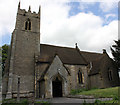
Photos of DN21 5EA


Area Information
DN21 5EA is a small, tightly knit residential postcode in England, home to 2,116 people spread across a low-density area. Its modest size and 75 people per km² suggest a quiet, community-focused environment. The area’s character is defined by its demographic profile: predominantly adults aged 30–64, with a median age of 47. This suggests a stable, mature population, likely with established careers and families. Daily life here is likely shaped by local amenities, such as nearby shops and rail links, and the low crime risk reported in assessments. The absence of major environmental constraints—such as protected woodlands or flood-prone zones—means residents face minimal planning restrictions. While the area is small, its proximity to Gainsborough’s rail stations and retail outlets provides practical connectivity. For buyers, DN21 5EA offers a blend of tranquility and accessibility, though its limited size means opportunities for expansion are constrained. The low flood risk and safety score of 90/100 further reinforce its appeal as a secure, low-maintenance place to live.
- Area Type
- Postcode
- Area Size
- Not available
- Population
- 2116
- Population Density
- 75 people/km²
The property market in DN21 5EA is dominated by owner-occupied homes, with 86% of residents living in their own properties. This high home ownership rate indicates a stable, long-term community rather than a rental market. The accommodation type is primarily houses, which is typical of smaller, low-density areas. This suggests a focus on family homes with private outdoor space, though the limited size of the postcode means the housing stock is unlikely to be extensive. Buyers should consider that the area’s small size may restrict availability, particularly for new builds or larger properties. The absence of rental properties implies that the market is not geared toward investors or short-term lets. For those seeking a home, the emphasis on owner-occupation and houses may appeal to families or individuals prioritising space and security. However, the limited scale of the area means buyers should explore nearby postcodes for more options.
House Prices in DN21 5EA
No properties found in this postcode.
Energy Efficiency in DN21 5EA
Residents of DN21 5EA have access to a range of nearby amenities, including five retail outlets such as Spar Warren, Morrisons Gainsborough, and Aldi Gainsborough. These shops provide convenience for daily errands, from groceries to household essentials. The area is also served by two railway stations, Gainsborough Lea Road and Gainsborough Central, which connect to broader transport networks. While the data does not mention parks or leisure facilities, the presence of retail and rail options suggests a practical, community-focused lifestyle. The low population density and quiet nature of the area may appeal to those seeking a balance between convenience and tranquillity. However, buyers should note that the absence of detailed information on leisure or green spaces means these aspects would require further local investigation. The overall lifestyle in DN21 5EA appears to prioritise accessibility and simplicity, with amenities focused on essentials rather than luxury.
Amenities
Schools
The nearest school to DN21 5EA is Frances Olive Anderson Church of England (Aided) Primary School, which has an Ofsted rating of ‘good’. This primary school serves the local community, providing education for younger children. The absence of secondary schools in the data means families may need to look beyond the immediate area for secondary education. The presence of a primary school with a good rating is a positive factor for families with young children, though it does not address the need for secondary schooling. The school’s religious affiliation may align with local demographics, but no further details on its size or performance are provided. For parents, the proximity of a quality primary school is a key consideration, though the lack of secondary options could influence decisions about long-term residency.
| Rank | School | Type | Entry gender | Ages |
|---|
Explore more schools in this area
Go to Schools tabDemographics
The community in DN21 5EA is predominantly composed of adults aged 30–64, with a median age of 47. This suggests a mature, stable population, likely with long-term ties to the area. Home ownership is high, with 86% of residents living in owner-occupied properties. The accommodation type is primarily houses, indicating a less densely populated, suburban or semi-rural character. The predominant ethnic group is White, though no specific data on other groups is provided. The low population density of 75 people per km² reinforces the area’s quiet, residential nature. While no deprivation data is included, the high home ownership and low crime risk imply a relatively affluent, secure environment. The demographic profile suggests a community focused on stability, with limited turnover of residents. This could mean a strong sense of local identity but potentially fewer amenities tailored to younger or more transient populations.
Household Size
Accommodation Type
Tenure
Ethnic Group
Religion
Household Composition
Age
Household Deprivation
NS-SEC
Explore more demographic insights in this area
Go to Demographics tabPlanning
Planning Constraints
- Flood RiskPremium
- Ramsar Wetland SitesPremium
- Area of Outstanding Natural BeautyPremium
- Protected Nature ReservePremium
- Protected WoodlandPremium