Area Overview for DN21 1WB
Photos of DN21 1WB
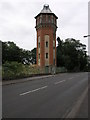


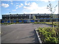
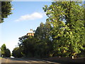
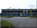

12 photos from this area
Area Information
Key information about the DN21 1WB including its size, population, and administrative classification.
- Area Type
- Postcode
- Area Size
- 5200 m²
- Population
- 2210
- Population Density
- 4495 people/km²
House Prices in DN21 1WB
9
Properties
£194,461
Average Sold Price
£104,950
Lowest Price
£280,000
Highest Price
Showing 9 properties
| Address | Type | Beds | Baths | Last Sale Price | Last Sale Date | |
|---|---|---|---|---|---|---|
| 6 Blackthorn Close, Gainsborough, DN21 1WB | Detached | 4 | 2 | £265,000 | Nov 2025 | |
| 3 Blackthorn Close, Gainsborough, DN21 1WB | house | 4 | 2 | £280,000 | May 2022 | |
| 10 Blackthorn Close, Gainsborough, DN21 1WB | Detached | 4 | 2 | £236,000 | May 2018 | |
| 2 Blackthorn Close, Gainsborough, DN21 1WB | Detached | 4 | 2 | £192,500 | Apr 2018 | |
| 8 Blackthorn Close, Gainsborough, DN21 1WB | house | 4 | - | £179,000 | Mar 2016 | |
| 4 Blackthorn Close, Gainsborough, DN21 1WB | Detached | - | - | £190,000 | Feb 2007 | |
| 5 Blackthorn Close, Gainsborough, DN21 1WB | Detached | 4 | 2 | £193,750 | Aug 2006 | |
| 7 Blackthorn Close, Gainsborough, DN21 1WB | Detached | - | - | £108,950 | Mar 2002 | |
| 1 Blackthorn Close, Gainsborough, DN21 1WB | Detached | - | - | £104,950 | Feb 2002 |
Energy Efficiency in DN21 1WB
Amenities
Schools
| Rank | School | Type | Entry gender | Ages |
|---|
Explore more schools in this area
Go to Schools tabDemographics
Household Size
Two person
most common
Accommodation Type
Houses
most common
Tenure
60
majority
Ethnic Group
White
most common
Religion
N/A
most common
Household Composition
N/A
most common
Age
47
median
Adults (30-64 years)
most common
Household Deprivation
N/A
with no deprivation
NS-SEC
20
in Lower managerial occupations
Explore more demographic insights in this area
Go to Demographics tabPlanning
Planning Constraints
- Flood RiskPremium
- Ramsar Wetland SitesPremium
- Area of Outstanding Natural BeautyPremium
- Protected Nature ReservePremium
- Protected WoodlandPremium