Area Overview for DN20 9EY
Photos of DN20 9EY
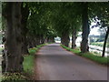
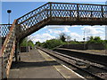
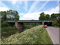
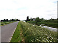
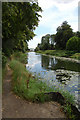
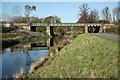
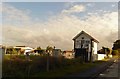
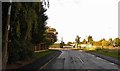
47 photos from this area
Area Information
Key information about the DN20 9EY including its size, population, and administrative classification.
- Area Type
- Postcode
- Area Size
- 43.3 hectares
- Population
- 2676
- Population Density
- 34 people/km²
House Prices in DN20 9EY
42
Properties
£184,357
Average Sold Price
£47,000
Lowest Price
£340,000
Highest Price
Showing 42 properties
| Address | Type | Beds | Baths | Last Sale Price | Last Sale Date | |
|---|---|---|---|---|---|---|
| 21 Westrum Lane, Brigg, DN20 9EY | Detached | 4 | 2 | £340,000 | Apr 2023 | |
| 8 Westrum Lane, Brigg, DN20 9EY | Detached | 3 | 1 | £320,000 | Nov 2022 | |
| Shahdene, Westrum Lane, Brigg, DN20 9EY | Retail | 3 | 1 | £249,950 | Jul 2022 | |
| York Cottage, Westrum Lane, Brigg, DN20 9EY | house | 5 | - | £245,000 | Jun 2021 | |
| Woodrow, Westrum Lane, Brigg, DN20 9EY | Detached | 5 | 3 | £265,000 | Oct 2020 | |
| 7 Westrum Lane, Brigg, DN20 9EY | house | - | - | £230,000 | Jul 2017 | |
| Rose Lyn, Westrum Lane, Brigg, DN20 9EY | Bungalow | - | - | £285,000 | Dec 2016 | |
| 11 Westrum Lane, Brigg, DN20 9EY | Detached | 4 | 3 | £219,950 | Feb 2016 | |
| 28 Westrum Lane, Brigg, DN20 9EY | Detached | 4 | 1 | £186,000 | Oct 2015 | |
| 24 Westrum Lane, Brigg, DN20 9EY | Detached | 4 | 1 | £175,000 | Apr 2015 |
Page 1 of 5
Energy Efficiency in DN20 9EY
Amenities
Schools
| Rank | School | Type | Entry gender | Ages |
|---|
Explore more schools in this area
Go to Schools tabDemographics
Household Size
Two person
most common
Accommodation Type
Houses
most common
Tenure
82
majority
Ethnic Group
White
most common
Religion
N/A
most common
Household Composition
N/A
most common
Age
47
median
Adults (30-64 years)
most common
Household Deprivation
N/A
with no deprivation
NS-SEC
39
in Lower managerial occupations
Explore more demographic insights in this area
Go to Demographics tabPlanning
Planning Constraints
- Flood RiskPremium
- Ramsar Wetland SitesPremium
- Area of Outstanding Natural BeautyPremium
- Protected Nature ReservePremium
- Protected WoodlandPremium