Area Overview for DN11 8EB
Photos of DN11 8EB
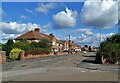
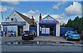
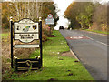
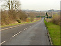
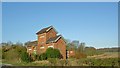
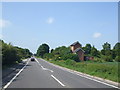
12 photos from this area
Area Information
Key information about the DN11 8EB including its size, population, and administrative classification.
- Area Type
- Postcode
- Area Size
- 7353 m²
- Population
- 1405
- Population Density
- 3757 people/km²
House Prices in DN11 8EB
17
Properties
£72,189
Average Sold Price
£22,500
Lowest Price
£105,000
Highest Price
Showing 17 properties
| Address | Type | Beds | Baths | Last Sale Price | Last Sale Date | |
|---|---|---|---|---|---|---|
| 18 Norfolk Road, Bircotes, DN11 8EB | Semi-detached | 3 | 1 | £104,000 | Oct 2024 | |
| 14 Norfolk Road, Bircotes, DN11 8EB | Semi-detached | 3 | 1 | £102,500 | Nov 2020 | |
| 2 Norfolk Road, Bircotes, DN11 8EB | Semi-detached | 3 | 1 | £95,450 | Dec 2015 | |
| 10 Norfolk Road, Bircotes, DN11 8EB | house | - | - | £72,750 | Aug 2015 | |
| 26 Norfolk Road, Bircotes, DN11 8EB | house | - | - | £105,000 | Jun 2008 | |
| 20 Norfolk Road, Bircotes, DN11 8EB | Semi-detached | 3 | - | £83,500 | Nov 2005 | |
| 28 Norfolk Road, Bircotes, DN11 8EB | Semi-detached | - | - | £29,000 | May 2001 | |
| 4 Norfolk Road, Bircotes, DN11 8EB | Semi-detached | - | - | £22,500 | Jan 1996 | |
| 6 Norfolk Road, Bircotes, DN11 8EB | Semi-detached | - | - | £35,000 | Dec 1995 | |
| 30 Norfolk Road, Bircotes, DN11 8EB | Semi-detached | - | - | - | - |
Page 1 of 2
Energy Efficiency in DN11 8EB
Amenities
Schools
| Rank | School | Type | Entry gender | Ages |
|---|
Explore more schools in this area
Go to Schools tabDemographics
Household Size
Two person
most common
Accommodation Type
Houses
most common
Tenure
66
majority
Ethnic Group
White
most common
Religion
N/A
most common
Household Composition
N/A
most common
Age
47
median
Adults (30-64 years)
most common
Household Deprivation
N/A
with no deprivation
NS-SEC
18
in Lower managerial occupations
Explore more demographic insights in this area
Go to Demographics tabPlanning
Planning Constraints
- Flood RiskPremium
- Ramsar Wetland SitesPremium
- Area of Outstanding Natural BeautyPremium
- Protected Nature ReservePremium
- Protected WoodlandPremium