Area Overview for DN10 6AY
Photos of DN10 6AY
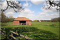
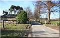
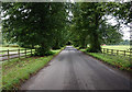
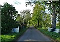
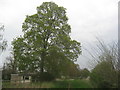
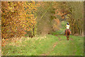
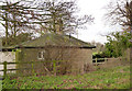
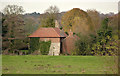
21 photos from this area
Area Information
Key information about the DN10 6AY including its size, population, and administrative classification.
- Area Type
- Postcode
- Area Size
- 1.1 km²
- Population
- 2302
- Population Density
- 85 people/km²
House Prices in DN10 6AY
10
Properties
£72,267
Average Sold Price
£34,500
Lowest Price
£102,300
Highest Price
Showing 10 properties
| Address | Type | Beds | Baths | Last Sale Price | Last Sale Date | |
|---|---|---|---|---|---|---|
| 2, Scrooby Top Cottages, Great North Road, Scrooby, DN10 6AY | house | - | - | £80,000 | Aug 2010 | |
| 1, Scrooby Top Cottages, Great North Road, Scrooby, DN10 6AY | house | 2 | 1 | £102,300 | Dec 2009 | |
| 5, Scrooby Top Cottages, Great North Road, Scrooby, DN10 6AY | house | - | - | £34,500 | Oct 1999 | |
| 3, Scrooby Top Cottages, Great North Road, Scrooby, DN10 6AY | house | 2 | 1 | - | - | |
| Scrooby Top Farm, Snape Lane, Scrooby, DN10 6AY | house | - | - | - | - | |
| 4, Scrooby Top Cottages, Great North Road, Scrooby, DN10 6AY | house | 1 | 1 | - | - | |
| Overhead Line South Of, Snape Lane, Scrooby, DN10 6AY | commercial | - | - | - | - | |
| Bishopfield Lodge, Access Road Bishopfield Farm, Scrooby, DN10 6AY | Bungalow | - | - | - | - | |
| Scrooby Top House, Great North Road, Ranskill, DN10 6AY | Terraced | 2 | - | - | - | |
| The Bungalow, Hawks Nest Garden And Pet Centre, Great North Road, Scrooby, DN10 6AY | Detached | - | - | - | - |
Energy Efficiency in DN10 6AY
Amenities
Schools
| Rank | School | Type | Entry gender | Ages |
|---|
Explore more schools in this area
Go to Schools tabDemographics
Household Size
Two person
most common
Accommodation Type
Houses
most common
Tenure
78
majority
Ethnic Group
White
most common
Religion
N/A
most common
Household Composition
N/A
most common
Age
47
median
Adults (30-64 years)
most common
Household Deprivation
N/A
with no deprivation
NS-SEC
38
in Lower managerial occupations
Explore more demographic insights in this area
Go to Demographics tabPlanning
Planning Constraints
- Flood RiskPremium
- Ramsar Wetland SitesPremium
- Area of Outstanding Natural BeautyPremium
- Protected Nature ReservePremium
- Protected WoodlandPremium