Area Overview for DN10 4HF
Photos of DN10 4HF
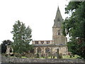
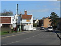
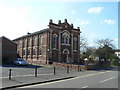
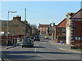
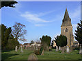
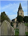
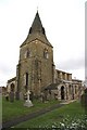
94 photos from this area
Area Information
Key information about the DN10 4HF including its size, population, and administrative classification.
- Area Type
- Postcode
- Area Size
- 7.1 hectares
- Population
- 1155
- Population Density
- 372 people/km²
House Prices in DN10 4HF
41
Properties
£157,194
Average Sold Price
£48,000
Lowest Price
£350,000
Highest Price
Showing 41 properties
| Address | Type | Beds | Baths | Last Sale Price | Last Sale Date | |
|---|---|---|---|---|---|---|
| 20 Grove Park, Misterton, DN10 4HF | Detached | 4 | 1 | £341,000 | Oct 2025 | |
| 33 Grove Park, Misterton, DN10 4HF | Detached | 3 | 1 | £292,500 | Feb 2025 | |
| 41 Grove Park, Misterton, DN10 4HF | Detached | 4 | 2 | £350,000 | Oct 2024 | |
| 9 Grove Park, Misterton, DN10 4HF | Bungalow | 2 | 1 | £175,000 | Dec 2022 | |
| The Lilacs, 30 Grove Park, Misterton, DN10 4HF | Bungalow | 3 | - | £252,000 | Aug 2020 | |
| 11 Grove Park, Misterton, DN10 4HF | Detached | 3 | - | £200,000 | Mar 2020 | |
| 43 Grove Park, Misterton, DN10 4HF | Detached | 3 | 2 | £198,000 | Nov 2019 | |
| 2 Grove Park, Misterton, DN10 4HF | Bungalow | - | - | £205,000 | Nov 2019 | |
| 29 Grove Park, Misterton, DN10 4HF | Detached | 3 | 1 | £170,000 | Nov 2018 | |
| 7 Grove Park, Misterton, DN10 4HF | Bungalow | - | - | £90,000 | Jul 2017 |
Page 1 of 5
Energy Efficiency in DN10 4HF
Amenities
Schools
| Rank | School | Type | Entry gender | Ages |
|---|
Explore more schools in this area
Go to Schools tabDemographics
Household Size
Two person
most common
Accommodation Type
Houses
most common
Tenure
70
majority
Ethnic Group
White
most common
Religion
N/A
most common
Household Composition
N/A
most common
Age
47
median
Adults (30-64 years)
most common
Household Deprivation
N/A
with no deprivation
NS-SEC
26
in Lower managerial occupations
Explore more demographic insights in this area
Go to Demographics tabPlanning
Planning Constraints
- Flood RiskPremium
- Ramsar Wetland SitesPremium
- Area of Outstanding Natural BeautyPremium
- Protected Nature ReservePremium
- Protected WoodlandPremium