Area Overview for DN10 4FW
Photos of DN10 4FW
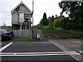
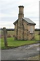
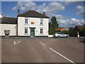
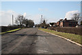
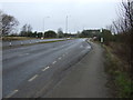
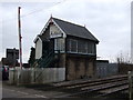
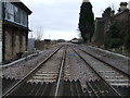
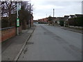
57 photos from this area
Area Information
Key information about the DN10 4FW including its size, population, and administrative classification.
- Area Type
- Postcode
- Area Size
- 3.9 hectares
- Population
- 2495
- Population Density
- 88 people/km²
House Prices in DN10 4FW
67
Properties
£296,917
Average Sold Price
£42,500
Lowest Price
£1,250,000
Highest Price
Showing 67 properties
| Address | Type | Beds | Baths | Last Sale Price | Last Sale Date | |
|---|---|---|---|---|---|---|
| 52 Deerlands Way, Beckingham, DN10 4FW | Semi-detached | 3 | 1 | £92,500 | Nov 2025 | |
| 47 Deerlands Way, Beckingham, DN10 4FW | house | - | - | £42,500 | Oct 2021 | |
| 51 Deerlands Way, Beckingham, DN10 4FW | Detached | 3 | 1 | £87,500 | Sep 2021 | |
| 48 Deerlands Way, Beckingham, DN10 4FW | house | - | - | £75,000 | Jun 2021 | |
| 8 Deerlands Way, Beckingham, DN10 4FW | house | - | - | £234,000 | Dec 2018 | |
| 61 Deerlands Way, Beckingham, DN10 4FW | house | - | - | £1,250,000 | Dec 2018 | |
| 66 Deerlands Way, Beckingham, DN10 4FW | Semi-detached | 3 | 1 | - | - | |
| 27 Deerlands Way, Beckingham, DN10 4FW | Semi-detached | 3 | 1 | - | - | |
| 28 Deerlands Way, Beckingham, DN10 4FW | Semi-detached | 3 | 1 | - | - | |
| 23 Deerlands Way, Beckingham, DN10 4FW | Retail | 3 | 1 | - | - |
Page 1 of 7
Energy Efficiency in DN10 4FW
Amenities
Schools
| Rank | School | Type | Entry gender | Ages |
|---|
Explore more schools in this area
Go to Schools tabDemographics
Household Size
Two person
most common
Accommodation Type
Houses
most common
Tenure
78
majority
Ethnic Group
White
most common
Religion
N/A
most common
Household Composition
N/A
most common
Age
47
median
Adults (30-64 years)
most common
Household Deprivation
N/A
with no deprivation
NS-SEC
33
in Lower managerial occupations
Explore more demographic insights in this area
Go to Demographics tabPlanning
Planning Constraints
- Flood RiskPremium
- Ramsar Wetland SitesPremium
- Area of Outstanding Natural BeautyPremium
- Protected Nature ReservePremium
- Protected WoodlandPremium