Area Overview for Dishley, Hathern & Thorpe Acre Ward
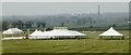
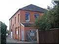
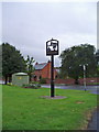
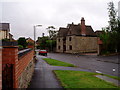
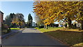
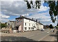
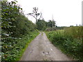
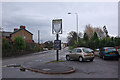
Photos of Dishley, Hathern & Thorpe Acre Ward
Area Information
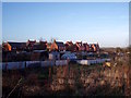
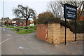
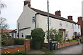
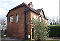
Dishley, Hathern & Thorpe Acre Ward covers a geographically defined area of 13.0 square kilometres within the East Midlands region of England. This district borough unitary ward forms part of Charnwood Borough Council and encapsulates three distinct local communities: Dishley, Hathern, and Thorpe Acre. The location sits near Loughborough, established on the political map to ensure electoral fairness across the constituency. Living in Dishley, Hathern & Thorpe Acre Ward means residing in a setting that is geographically compact yet administratively specific to this three-councillor ward. The area functions as a cohesive electoral unit despite comprising different village settlements. Prospective residents should understand the precise boundaries and council oversight when considering homes in this specific ward. The coordinates, approximately 52.786258, -1.256418, pinpoint the centre of this administrative zone within Leicestershire. This area represents a settled community structure under the governance of Charnwood, offering a defined locality for those seeking stability within the English electoral system. Understanding the ward structure is essential for anyone navigating council services or political representation in this region.
- Area Type
- District Borough Unitary Ward
- Area Size
- 13.0 km²
- Population
- Not available
- Population Density
- Not available
Demographics
The community profile of Dishley, Hathern & Thorpe Acre Ward reveals an established settlement pattern. The median age within the ward stands at 70 years. This figure indicates a population skewed significantly towards older age groups compared to other regions in the UK. You will find that the most common age range recorded corresponds to the total population category provided in the ward data. This demographic skew influences daily life, community services, and the type of housing demand in the area. Home ownership is the dominant lifestyle choice here, with 76% of residents owning their properties. This high level of ownership suggests long-term settlement rather than transient tenancy. The ward data indicates total coverage for household composition, accommodation types, predominant ethnicity, and religion, though specific breakdowns within these totals are not detailed in the provided figures. Deprivation data is not directly quantified in the supplied dataset, but the high ownership rate and older demographic often correlate with stable, long-standing neighbourhoods. Living in Dishley, Hathern & Thorpe Acre Ward involves settling into a community where the majority of households have secured their own homes. This environment typically caters to residents prioritising stability over rapid market mobility.
Household Size
Accommodation Type
Tenure
Ethnic Group
Religion
Household Composition
Age
Household Deprivation
NS-SEC
Explore more demographic insights in this area
Go to Demographics tabPlanning
Planning Constraints
- Flood RiskPremium
- Ramsar Wetland SitesPremium
- Area of Outstanding Natural BeautyPremium
- Protected Nature ReservePremium
- Protected WoodlandPremium
- Crime RiskPremium