Area Overview for DE74 2JR
Photos of DE74 2JR

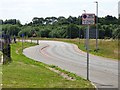


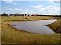
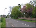
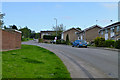
11 photos from this area
Area Information
Key information about the DE74 2JR including its size, population, and administrative classification.
- Area Type
- Postcode
- Area Size
- 1.8 hectares
- Population
- 1597
- Population Density
- 434 people/km²
House Prices in DE74 2JR
43
Properties
£137,269
Average Sold Price
£39,750
Lowest Price
£225,000
Highest Price
Showing 43 properties
| Address | Type | Beds | Baths | Last Sale Price | Last Sale Date | |
|---|---|---|---|---|---|---|
| 64 Shields Crescent, Castle Donington, DE74 2JR | Semi-detached | 3 | 1 | £225,000 | Nov 2024 | |
| 67 Shields Crescent, Castle Donington, DE74 2JR | Terraced | 2 | 1 | £185,000 | Aug 2023 | |
| 91 Shields Crescent, Castle Donington, DE74 2JR | Semi-detached | 3 | - | £150,000 | Oct 2022 | |
| 77 Shields Crescent, Castle Donington, DE74 2JR | Semi-detached | 3 | 1 | £225,000 | Oct 2020 | |
| 89 Shields Crescent, Castle Donington, DE74 2JR | Semi-detached | 3 | 1 | £150,000 | Apr 2020 | |
| 62 Shields Crescent, Castle Donington, DE74 2JR | Semi-detached | 4 | 2 | £155,000 | Feb 2020 | |
| 95 Shields Crescent, Castle Donington, DE74 2JR | house | - | - | £155,000 | Jul 2019 | |
| 71 Shields Crescent, Castle Donington, DE74 2JR | house | - | - | £136,000 | Dec 2017 | |
| 60 Shields Crescent, Castle Donington, DE74 2JR | house | - | - | £85,000 | May 2012 | |
| 75 Shields Crescent, Castle Donington, DE74 2JR | house | 3 | - | £127,750 | Nov 2006 |
Page 1 of 5
Energy Efficiency in DE74 2JR
Amenities
Schools
| Rank | School | Type | Entry gender | Ages |
|---|
Explore more schools in this area
Go to Schools tabDemographics
Household Size
Family (3-5 people)
most common
Accommodation Type
Houses
most common
Tenure
71
majority
Ethnic Group
White
most common
Religion
N/A
most common
Household Composition
N/A
most common
Age
47
median
Adults (30-64 years)
most common
Household Deprivation
N/A
with no deprivation
NS-SEC
29
in Lower managerial occupations
Explore more demographic insights in this area
Go to Demographics tabPlanning
Planning Constraints
- Flood RiskPremium
- Ramsar Wetland SitesPremium
- Area of Outstanding Natural BeautyPremium
- Protected Nature ReservePremium
- Protected WoodlandPremium