Area Overview for DE74 2AY
Photos of DE74 2AY


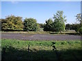
66 photos from this area
Area Information
Key information about the DE74 2AY including its size, population, and administrative classification.
- Area Type
- Postcode
- Area Size
- 1.7 hectares
- Population
- 1705
- Population Density
- 100 people/km²
House Prices in DE74 2AY
48
Properties
£227,331
Average Sold Price
£124,995
Lowest Price
£384,950
Highest Price
Showing 48 properties
| Address | Type | Beds | Baths | Last Sale Price | Last Sale Date | |
|---|---|---|---|---|---|---|
| 1 Pritchard Drive, Kegworth, DE74 2AY | Detached | 5 | 3 | £384,950 | Oct 2025 | |
| 29 Pritchard Drive, Kegworth, DE74 2AY | Detached | 3 | 2 | £230,000 | Mar 2025 | |
| 27 Pritchard Drive, Kegworth, DE74 2AY | Semi-detached | 2 | 1 | £205,000 | Feb 2025 | |
| 75 Pritchard Drive, Kegworth, DE74 2AY | house | 4 | 2 | £280,000 | Feb 2025 | |
| 35 Pritchard Drive, Kegworth, DE74 2AY | house | - | - | £240,000 | Aug 2024 | |
| 19 Pritchard Drive, Kegworth, DE74 2AY | Semi-detached | 3 | 3 | £235,000 | Feb 2024 | |
| 79 Pritchard Drive, Kegworth, DE74 2AY | Detached | 3 | 2 | £280,000 | Jun 2023 | |
| 17 Pritchard Drive, Kegworth, DE74 2AY | Semi-detached | 4 | 2 | £278,500 | Mar 2023 | |
| 3 Pritchard Drive, Kegworth, DE74 2AY | Semi-detached | 3 | 2 | £263,000 | Dec 2022 | |
| 15 Pritchard Drive, Kegworth, DE74 2AY | house | - | - | £367,500 | Nov 2022 |
Page 1 of 5
Energy Efficiency in DE74 2AY
Amenities
Schools
| Rank | School | Type | Entry gender | Ages |
|---|
Explore more schools in this area
Go to Schools tabDemographics
Household Size
Two person
most common
Accommodation Type
Houses
most common
Tenure
78
majority
Ethnic Group
White
most common
Religion
N/A
most common
Household Composition
N/A
most common
Age
47
median
Adults (30-64 years)
most common
Household Deprivation
N/A
with no deprivation
NS-SEC
43
in Lower managerial occupations
Explore more demographic insights in this area
Go to Demographics tabPlanning
Planning Constraints
- Flood RiskPremium
- Ramsar Wetland SitesPremium
- Area of Outstanding Natural BeautyPremium
- Protected Nature ReservePremium
- Protected WoodlandPremium