Area Overview for DE73 8BF
Photos of DE73 8BF

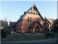
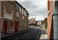
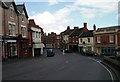
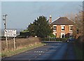
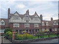
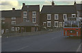
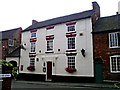
100 photos from this area
Area Information
Key information about the DE73 8BF including its size, population, and administrative classification.
- Area Type
- Postcode
- Area Size
- 1.4 hectares
- Population
- 2001
- Population Density
- 1928 people/km²
House Prices in DE73 8BF
39
Properties
£138,903
Average Sold Price
£59,950
Lowest Price
£215,500
Highest Price
Showing 39 properties
| Address | Type | Beds | Baths | Last Sale Price | Last Sale Date | |
|---|---|---|---|---|---|---|
| 23 Castle Mills, Melbourne, Derby, DE73 8BF | Detached | 1 | 1 | £140,000 | Aug 2025 | |
| 53 Castle Mills, Melbourne, Derby, DE73 8BF | Maisonette | - | - | £155,000 | Jul 2025 | |
| 49 Castle Mills, Melbourne, Derby, DE73 8BF | Flat | - | - | £215,500 | Mar 2025 | |
| 47 Castle Mills, Melbourne, Derby, DE73 8BF | Semi-detached | 2 | 1 | £190,000 | Nov 2024 | |
| 41 Castle Mills, Melbourne, Derby, DE73 8BF | Semi-detached | 2 | 1 | £200,000 | Apr 2024 | |
| 35 Castle Mills, Melbourne, Derby, DE73 8BF | Flat | 2 | - | £177,500 | Jan 2024 | |
| 57 Castle Mills, Melbourne, Derby, DE73 8BF | Flat | - | - | £160,000 | Jan 2023 | |
| 33 Castle Mills, Melbourne, Derby, DE73 8BF | Flat | 2 | 1 | £168,000 | Apr 2022 | |
| 43 Castle Mills, Melbourne, Derby, DE73 8BF | house | 2 | - | £195,000 | Apr 2022 | |
| 29 Castle Mills, Melbourne, Derby, DE73 8BF | Terraced | 2 | 1 | £160,000 | Jul 2021 |
Page 1 of 4
Energy Efficiency in DE73 8BF
Amenities
Schools
| Rank | School | Type | Entry gender | Ages |
|---|
Explore more schools in this area
Go to Schools tabDemographics
Household Size
One person
most common
Accommodation Type
Houses
most common
Tenure
61
majority
Ethnic Group
White
most common
Religion
N/A
most common
Household Composition
N/A
most common
Age
47
median
Adults (30-64 years)
most common
Household Deprivation
N/A
with no deprivation
NS-SEC
43
in Lower managerial occupations
Explore more demographic insights in this area
Go to Demographics tabPlanning
Planning Constraints
- Flood RiskPremium
- Ramsar Wetland SitesPremium
- Area of Outstanding Natural BeautyPremium
- Protected Nature ReservePremium
- Protected WoodlandPremium