Area Overview for DE73 7HA
Photos of DE73 7HA
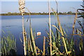
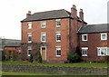
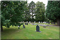
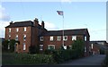
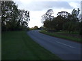
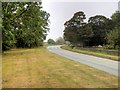
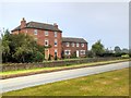


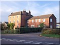
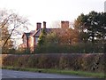
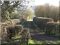
14 photos from this area
Area Information
Key information about the DE73 7HA including its size, population, and administrative classification.
- Area Type
- Postcode
- Area Size
- 2.8 km²
- Population
- 2502
- Population Density
- 135 people/km²
House Prices in DE73 7HA
66
Properties
£266,489
Average Sold Price
£65,000
Lowest Price
£615,000
Highest Price
Showing 66 properties
| Address | Type | Beds | Baths | Last Sale Price | Last Sale Date | |
|---|---|---|---|---|---|---|
| 19 Twyford Road, Barrow On Trent, Derby, DE73 7HA | Cottage | 3 | 1 | £320,000 | Aug 2024 | |
| Rose Cottage, Twyford Road, Barrow On Trent, Derby, DE73 7HA | Detached | 4 | - | £420,000 | Apr 2024 | |
| 27 Twyford Road, Barrow On Trent, Derby, DE73 7HA | Bungalow | 2 | 1 | £275,000 | Oct 2023 | |
| 15 Twyford Road, Barrow On Trent, Derby, DE73 7HA | Detached | - | - | £233,338 | Feb 2023 | |
| 41 Twyford Road, Barrow On Trent, Derby, DE73 7HA | Bungalow | 2 | 1 | £234,000 | May 2022 | |
| 31 Twyford Road, Barrow On Trent, Derby, DE73 7HA | Bungalow | 2 | 1 | £225,000 | Oct 2019 | |
| 32A Twyford Road, Barrow On Trent, Derby, DE73 7HA | Detached | 1 | 1 | £305,000 | Jul 2019 | |
| Field Farm House, Twyford Road, Twyford, Derby, DE73 7HA | house | - | - | £490,000 | Jul 2018 | |
| 66 Twyford Road, Barrow On Trent, Derby, DE73 7HA | house | - | - | £250,000 | Oct 2017 | |
| Old Manor Farm, Twyford Road, Barrow On Trent, Derby, DE73 7HA | house | 5 | 2 | £615,000 | Jul 2016 |
Page 1 of 7
Energy Efficiency in DE73 7HA
Amenities
Schools
| Rank | School | Type | Entry gender | Ages |
|---|
Explore more schools in this area
Go to Schools tabDemographics
Household Size
Two person
most common
Accommodation Type
Houses
most common
Tenure
80
majority
Ethnic Group
White
most common
Religion
N/A
most common
Household Composition
N/A
most common
Age
47
median
Adults (30-64 years)
most common
Household Deprivation
N/A
with no deprivation
NS-SEC
45
in Lower managerial occupations
Explore more demographic insights in this area
Go to Demographics tabPlanning
Planning Constraints
- Flood RiskPremium
- Ramsar Wetland SitesPremium
- Area of Outstanding Natural BeautyPremium
- Protected Nature ReservePremium
- Protected WoodlandPremium